Active outdoor pursuits
Results 361 - 384 of 2246
Active outdoor pursuits
Paperback. William Hutchison Murray (1913 - 1996) was one of Scotland's most distinguished climbers in the years before and after the Second World War. He became a writer of non-fiction, novelist, distinguished conservationist. Num Pages: 386 pages, 50. BIC Classification: BGS; WSZG. Category: (G) General (US: Trade). Dimension: 200 x 131 x 31. Weight in Grams: 414.
- Publisher
- Sandstone Press Ltd
- Format
- Paperback
- Publication date
- 2014
- Condition
- New
- SKU
- V9781910124185
- ISBN
- 9781910124185
Paperback
Condition: New
€ 13.99€ 11.16
€ 13.99
€ 11.16
Paperback. Fiona Danks and Jo Schofield offer suggestions for things to do with a stick, in the way of adventures and bushcraft, creative and imaginative play, games, woodcraft and conservation, music and more. Num Pages: 128 pages, 100 colour photographs. BIC Classification: WN; WSZ. Category: (G) General (US: Trade). Dimension: 199 x 138 x 9. Weight in Grams: 272.
- Publisher
- Quarto Publishing PLC
- Number of pages
- 128
- Format
- Paperback
- Publication date
- 2012
- Condition
- New
- SKU
- V9780711232419
- ISBN
- 9780711232419
Paperback
Condition: New
€ 13.99€ 10.98
€ 13.99
€ 10.98
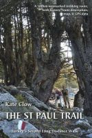
Paperback. A guide and map to Turkey's second long-distance walking route. It consists of about 500km of waymarked walking trail following Roman roads, village paths and medieval trails through the Toros mountains. Num Pages: 160 pages, b&w photos and tear-out map. BIC Classification: 1DVT; WSZC; WTH. Category: (G) General (US: Trade). Dimension: 239 x 163 x 18. Weight in Grams: 310.
- Publisher
- Upcountry (Turkey) Ltd
- Number of pages
- 160
- Format
- Paperback
- Publication date
- 2013
- Edition
- 2nd edition
- Condition
- New
- SKU
- V9780957154711
- ISBN
- 9780957154711
Paperback
Condition: New
€ 21.99€ 20.08
€ 21.99
€ 20.08
paperback. Num Pages: 256 pages, Illustrations. BIC Classification: VFMG; VXA; WSZC. Category: (G) General (US: Trade). Dimension: 203 x 135 x 17. Weight in Grams: 230.
- Format
- Paperback
- Publication date
- 1998
- Publisher
- HarperOne United States
- Number of pages
- 256
- Condition
- New
- Edition
- Illustrated
- SKU
- V9780060647360
- ISBN
- 9780060647360
Paperback
Condition: New
€ 19.99€ 18.12
€ 19.99
€ 18.12
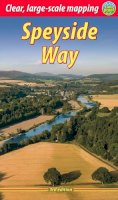
Spiral bound. The Speyside Way runs for 80 miles from the fishing port of Buckie to Aviemore in the foothills of the Cairngorms. This edition of the trail guide has mapping from Footprint in five panels, and plans of villages en route and of Aviemore. It contains information needed to plan your holiday with summaries of distance, terrain and refreshment stops. Num Pages: 64 pages, 65+ colour photographs. BIC Classification: 1DBKSH; WSZC; WTH. Category: (G) General (US: Trade). Dimension: 222 x 147 x 12. Weight in Grams: 194.
- Format
- Spiralbound
- Publication date
- 2007
- Publisher
- Rucksack Readers
- Condition
- New
- SKU
- KTG0021614
- ISBN
- 9781898481270
Spiralbound
Condition: New
€ 4.99
€ 4.99
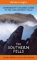
Paperback. Book 4 of a new set of Walkers Editions of Alfred Wainwright's Pictorial Guides to the Lakeland Fells, fully updated and checked by Clive Hutchby. Num Pages: 344 pages, illustrations. BIC Classification: 1DBKENM; WSZC; WTH. Category: (G) General (US: Trade). Dimension: 178 x 110. .
- Publisher
- Frances Lincoln Publishers Ltd
- Format
- Paperback
- Publication date
- 2017
- Edition
- Revised, Updated
- Condition
- New
- SKU
- V9780711236578
- ISBN
- 9780711236578
Paperback
Condition: New
€ 19.99€ 14.88
€ 19.99
€ 14.88
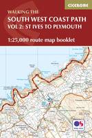
Paperback. Map of part of the southern section of the 630 mile (1014km) South West Coast Path National Trail. Covers the trail from St Ives to Plymouth along the west Cornwall and Devon coastline. This convenient and compact booklet of Ordnance Survey 1:25,000 maps shows the route, providing all of the mapping you need to walk the trail in either direction. Num Pages: 88 pages, OS 1:25,000 mapping and map legend. BIC Classification: 1DBKEW; WSZC; WTR. Category: (G) General (US: Trade). Dimension: 121 x 179 x 8. Weight in Grams: 120.
- Publisher
- Cicerone Press
- Format
- Paperback
- Publication date
- 2017
- Condition
- New
- SKU
- V9781852849375
- ISBN
- 9781852849375
Paperback
Condition: New
€ 17.99€ 13.87
€ 17.99
€ 13.87
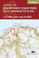
Paperback. Map of the northern section of the 630 mile (1014km) South West Coast Path National Trail. Covers the trail from Minehead to St Ives along the north Devon and Cornish coastline. This convenient and compact booklet of Ordnance Survey 1:25,000 maps shows the route, providing all of the mapping you need to walk the trail in either direction. Num Pages: 112 pages, OS 1:25,000 mapping and map legend. BIC Classification: 1DBKEW; WSZC; WTR. Category: (G) General (US: Trade). Dimension: 121 x 178 x 11. Weight in Grams: 148.
- Publisher
- Cicerone Press
- Format
- Paperback
- Publication date
- 2017
- Condition
- New
- SKU
- V9781852849368
- ISBN
- 9781852849368
Paperback
Condition: New
€ 17.99€ 17.18
€ 17.99
€ 17.18
Hardcover. Num Pages: 152 pages, 60 paintings in full colour, over 60 pencil studies, 20 ful. BIC Classification: 1DBKEWD; 5AN; WSZC; WTH. Category: (G) General (US: Trade). Dimension: 222 x 303 x 19. Weight in Grams: 1070.
- Publisher
- Halsgrove United Kingdom
- Number of pages
- 152
- Format
- Hardback
- Publication date
- 2008
- Edition
- 2nd
- Condition
- New
- SKU
- V9781841146904
- ISBN
- 9781841146904
Hardback
Condition: New
€ 33.99€ 28.03
€ 33.99
€ 28.03
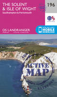
Sheet map, folded. .
- Publisher
- Ordnance Survey
- Publication date
- 2016
- Edition
- February 2016 ed
- Condition
- New
- SKU
- V9780319262948
- ISBN
- 9780319262948
Hardback
Condition: New
€ 17.99€ 13.89
€ 17.99
€ 13.89
Sheet map, folded. .
- Publisher
- Ordnance Survey
- Publication date
- 2016
- Edition
- February 2016 ed
- Condition
- New
- SKU
- V9780319475195
- ISBN
- 9780319475195
Hardback
Condition: New
€ 21.99€ 17.25
€ 21.99
€ 17.25
Paperback. .
- Publisher
- Cicerone Press
- Format
- Paperback
- Publication date
- 2017
- Condition
- New
- SKU
- V9781852848569
- ISBN
- 9781852848569
Paperback
Condition: New
€ 21.99€ 17.33
€ 21.99
€ 17.33
Paperback. Num Pages: 208 pages. BIC Classification: BGS; BTP; WSZG. Category: (G) General (US: Trade). Dimension: 157 x 234 x 16. Weight in Grams: 342.
- Publisher
- Luath Press Ltd
- Format
- Paperback
- Publication date
- 2016
- Edition
- Revised, New
- Condition
- New
- SKU
- V9781910745793
- ISBN
- 9781910745793
Paperback
Condition: New
€ 15.99€ 12.44
€ 15.99
€ 12.44
Hardcover. The Skye Trail is destined to be one of the most popular long distance walks in Britain. Adopted by the Highland Council as an official long distance walk, it was brought to life by BBC Scotland's often repeated "Skye Trail" presented by Cameron McNeish. This book is based on the broadcast and Cameron's experiences of the trail. Num Pages: 196 pages, colour photos & maps. BIC Classification: 1DBKSHQ; WSZC; WTH. Category: (G) General (US: Trade). Dimension: 226 x 198 x 16. Weight in Grams: 680. A Journey Through the Isle of Skye. 196 pages, colour photos & maps. The Skye Trail is destined to be one of the most popular long distance walks in Britain. Adopted by the Highland Council as an official long distance walk, it was brought to life by BBC Scotland's often repeated "Skye Trail" presented by Cameron McNeish. This book is based on the broadcast and Cameron's experiences of the trail. Cateogry: (G) General (US: Trade). BIC Classification: 1DBKSHQ; WSZC; WTH. Dimension: 226 x 198 x 16. Weight: 674.
- Publisher
- Mountain Media
- Number of pages
- 196
- Format
- Hardback
- Publication date
- 2010
- Condition
- New
- SKU
- V9780956295712
- ISBN
- 9780956295712
Hardback
Condition: New
€ 26.99€ 23.07
€ 26.99
€ 23.07
Paperback. Num Pages: 192 pages. BIC Classification: 1DBKS; BM; WSZG. Category: (G) General (US: Trade). Dimension: 210 x 135 x 1. .
- Publisher
- Luath Press Ltd
- Format
- Paperback
- Publication date
- 2016
- Edition
- 2nd Revised edition
- Condition
- New
- SKU
- V9781910745236
- ISBN
- 9781910745236
Paperback
Condition: New
€ 10.99€ 9.35
€ 10.99
€ 9.35
Paperback. Num Pages: maps. BIC Classification: 1DBKS; WSZC; WT. Category: (G) General (US: Trade). Dimension: 186 x 129 x 6. Weight in Grams: 122. maps. Cateogry: (G) General (US: Trade). BIC Classification: 1DBKS; WSZC; WT. Dimension: 186 x 129 x 6. Weight: 122.
- Publisher
- Challenge Pubns
- Format
- Paperback
- Publication date
- 2000
- Condition
- New
- SKU
- V9780952690085
- ISBN
- 9780952690085
Paperback
Condition: New
€ 10.13
€ 10.13
Paperback. This first ever complete guide to Scottish bothies reveals the country's unique and often hidden network of bothy cabins and mountain huts. Scattered across Scotland's most beautiful landscapes, these evocative abandoned crofts and farmsteads are free to stay in and offer a chance to experience the ultimate in wild adventure living. Num Pages: 304 pages, 100. BIC Classification: 1DBKS; WSZ; WTH. Category: (G) General (US: Trade). Dimension: 212 x 173 x 24. Weight in Grams: 746.
- Publisher
- Wild Things Publishing Ltd
- Format
- Paperback
- Publication date
- 2017
- Condition
- New
- SKU
- V9781910636107
- ISBN
- 9781910636107
Paperback
Condition: New
€ 21.99€ 17.35
€ 21.99
€ 17.35
Paperback. .
- Publisher
- Pocket Mountains Ltd
- Format
- Paperback
- Publication date
- 2016
- Condition
- New
- SKU
- V9781907025501
- ISBN
- 9781907025501
Paperback
Condition: New
€ 10.13
€ 10.13
Paperback. The essential manual on how to find your way anywhere in any situation. Series: SAS. Num Pages: 192 pages, black & white illustrations. BIC Classification: GBC; HBW; JWG; TRLN; WGG; WSZV. Category: (G) General (US: Trade). Dimension: 237 x 187 x 15. Weight in Grams: 554.
- Format
- Paperback
- Publication date
- 2002
- Publisher
- Lyons Press
- Edition
- 1st
- Condition
- New
- SKU
- V9781585744602
- ISBN
- 9781585744602
Paperback
Condition: New
€ 20.99€ 17.57
€ 20.99
€ 17.57
Paperback. Series: How to Climb Series. Num Pages: 256 pages, 49 colour illustrations, 226 colour illustrations. BIC Classification: WSD; WSZG; WSZV. Category: (G) General (US: Trade). Dimension: 232 x 193 x 13. Weight in Grams: 612.
- Format
- Paperback
- Publication date
- 2017
- Publisher
- Rowman & Littlefield
- Edition
- 2nd Revised ed.
- Condition
- New
- SKU
- V9781493017638
- ISBN
- 9781493017638
Paperback
Condition: New
€ 25.99€ 25.26
€ 25.99
€ 25.26
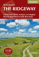
Paperback. Guidebook to the Ridgeway National Trail, an 87 mile (139km) route through the south of England from Avebury in Wiltshire to Ivinghoe Beacon in Buckinghamshire. Accompanied by a pull-out 1:25K mapping booklet, this guidebook details the trail in both directions and features information on historic sites and facilities along the way. Num Pages: 208 pages, 102 colour photos and 37 maps. BIC Classification: 1DBKES; 1DBKEW; WSZC; WTH. Category: (G) General (US: Trade). Dimension: 124 x 179 x 16. Weight in Grams: 312.
- Publisher
- Cicerone Press
- Format
- Paperback
- Publication date
- 2016
- Edition
- 2nd Revised edition
- Condition
- New
- SKU
- V9781852848743
- ISBN
- 9781852848743
Paperback
Condition: New
€ 21.99€ 17.33
€ 21.99
€ 17.33
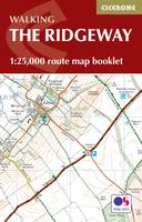
Paperback. Map of the 87 mile (139km) Ridgeway National Trail through the south of England from Avebury in Wiltshire to Ivinghoe Beacon in Buckinghamshire. This booklet is included with the Cicerone guidebook to the trail, and shows the full route on Ordnance Survey 1:25,000 maps. Presented in 12 stages in the guidebook, the trail typically takes 6-8 days. Num Pages: 56 pages, 56 pages of OS 1:25,000 mapping. BIC Classification: 1DBKE; WSZC; WTRM. Category: (G) General (US: Trade). Dimension: 115 x 170 x 7. Weight in Grams: 74.
- Publisher
- Cicerone Press
- Format
- Paperback
- Publication date
- 2016
- Condition
- New
- SKU
- V9781852849351
- ISBN
- 9781852849351
Paperback
Condition: New
€ 10.99€ 9.81
€ 10.99
€ 9.81
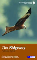
Paperback. The Ridgeway follows one of the oldest 'green roads' in Europe. Series: National Trail Guides. Num Pages: 168 pages, 50 colour illustrations. BIC Classification: 1DBKES; WSZC. Category: (G) General (US: Trade). Dimension: 133 x 210 x 10. Weight in Grams: 228.
- Publisher
- Aurum Press Ltd
- Format
- Paperback
- Publication date
- 2016
- Edition
- Re-issue
- Condition
- New
- SKU
- V9781781315736
- ISBN
- 9781781315736
Paperback
Condition: New
€ 19.99€ 14.88
€ 19.99
€ 14.88
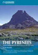
Paperback. A resource book covering the finest walks, treks and climbs in the High Pyrenees for 400km between France and Spain, from the Cirque de Lescun, on the edge of the Basque country in the west, to the Carlit massif and the Cerdagne to the east of Andorra. It is the first in our World Mountain Ranges series. Num Pages: 464 pages, Over 150 colour photos and 30 maps. BIC Classification: 1DSEP; WSZG; WTH. Category: (G) General (US: Trade). Dimension: 216 x 140 x 26. Weight in Grams: 820. The High Pyrenees from the Cirque De Lescun to the Carlit Massif. 464 pages, colour maps & photographs. A resource book covering the finest walks, treks and climbs in the High Pyrenees for 400km between France and Spain, from the Cirque de Lescun, on the edge of the Basque country in the west, to the Carlit massif and the Cerdagne to the east of Andorra. It is the first in our World Mountain Ranges series. Cateogry: (G) General (US: Trade). BIC Classification: 1DSEP; WSZG; WTH. Dimension: 216 x 140 x 26. Weight: 820.
- Publisher
- Cicerone Press Limited
- Number of pages
- 464
- Format
- Paperback
- Publication date
- 2004
- Edition
- 01st Edition
- Condition
- New
- SKU
- V9781852844202
- ISBN
- 9781852844202
Paperback
Condition: New
€ 29.99€ 21.54
€ 29.99
€ 21.54


