Active outdoor pursuits
Results 2161 - 2184 of 2289
Active outdoor pursuits
Paperback. The county of Ayrshire is located on the Firth of Clyde on the West Coast of Scotland and is known as one of the most fertile areas of the country, famed for its cattle and crops. This guide features 40 moderate walks which explore all aspects of the region, from craggy cliffs and caves to historic castles, ancient forests to sandy shorelines. Num Pages: 96 pages, full colour mapping & photography throughout. BIC Classification: 1DBKSB; WSZC; WTH. Category: (G) General (US: Trade). Dimension: 151 x 151 x 8. Weight in Grams: 124.
- Publisher
- Pocket Mountains Ltd United Kingdom
- Number of pages
- 96
- Format
- Paperback
- Publication date
- 2014
- Condition
- New
- SKU
- V9781907025396
- ISBN
- 9781907025396
Paperback
Condition: New
€ 10.03
€ 10.03
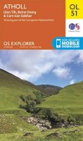
Sheet map, folded. .
- Publisher
- Ordnance Survey
- Publication date
- 2016
- Edition
- February 2016 ed
- Condition
- New
- SKU
- V9780319261682
- ISBN
- 9780319261682
Paperback
Condition: New
€ 17.99€ 13.77
€ 17.99
€ 13.77
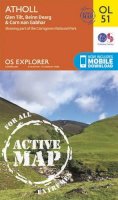
Sheet map, folded. .
- Publisher
- Ordnance Survey
- Publication date
- 2016
- Edition
- February 2016 ed
- Condition
- New
- SKU
- V9780319473931
- ISBN
- 9780319473931
Paperback
Condition: New
€ 21.99€ 17.05
€ 21.99
€ 17.05
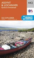
.
- Publisher
- Ordnance Survey
- Publication date
- 2015
- Edition
- September 2015 ed
- Condition
- New
- SKU
- V9780319471982
- ISBN
- 9780319471982
Paperback
Condition: New
€ 21.99€ 17.05
€ 21.99
€ 17.05
Paperback. Features 40 shorter walks that stretch from the ancient region of Badenoch and the uppermost reaches of the Spey Valley, through the outdoor hub of Aviemore to Grantown and Tomintoul, then over Ballater and Royal Deeside to Braemar. Series: Pocket Mountains S. Num Pages: 96 pages, full colour illustrations throughout. BIC Classification: 1DBKSH; WSZC; WTH. Category: (G) General (US: Trade). Dimension: 151 x 106 x 9. Weight in Grams: 128. 40 Shorter Walks. Series: Pocket Mountains S. 96 pages, full colour illustrations throughout. Features 40 shorter walks that stretch from the ancient region of Badenoch and the uppermost reaches of the Spey Valley, through the outdoor hub of Aviemore to Grantown and Tomintoul, then over Ballater and Royal Deeside to Braemar. Cateogry: (G) General (US: Trade). BIC Classification: 1DBKSH; WSZC; WTH. Dimension: 151 x 106 x 9. Weight: 124.
- Publisher
- Pocket Mountains
- Number of pages
- 96
- Format
- Paperback
- Publication date
- 2009
- Condition
- New
- SKU
- V9780955454875
- ISBN
- 9780955454875
Paperback
Condition: New
€ 10.03
€ 10.03
Paperback. With this handy guide, winter recreationists can reduce the risk of accident and injury. The concise and simple text explains the dangers associated with avalanches and how to avoid them. Series: Kestrel. Num Pages: 104 pages, black & white illustrations throughout. BIC Classification: WSW; WSZG. Category: (G) General (US: Trade). Dimension: 178 x 108 x 6. .
- Format
- Paperback
- Publication date
- 2007
- Publisher
- Rowman & Littlefield United States
- Edition
- 2 Rev ed
- Number of pages
- 104
- Condition
- New
- SKU
- V9780762738038
- ISBN
- 9780762738038
Paperback
Condition: New
€ 8.99€ 8.91
€ 8.99
€ 8.91
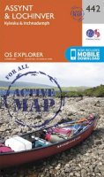
Sheet map, folded. .
- Publisher
- Ordnance Survey
- Publication date
- 2015
- Edition
- May 2015 ed
- Condition
- New
- SKU
- V9780319242902
- ISBN
- 9780319242902
Paperback
Condition: New
€ 17.99€ 13.80
€ 17.99
€ 13.80
Sheet map, folded. .
- Publisher
- Ordnance Survey
- Publication date
- 2015
- Edition
- May 2015 ed
- Condition
- New
- SKU
- V9780319469699
- ISBN
- 9780319469699
Paperback
Condition: New
€ 21.99€ 17.05
€ 21.99
€ 17.05
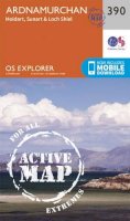
Sheet map, folded. Series: OS Explorer Map. BIC Classification: 1DBKSH; WSZC; WTRM. Category: (G) General (US: Trade). Dimension: 135 x 226 x 42. Weight in Grams: 100.
- Publisher
- Ordnance Survey
- Publication date
- 2015
- Edition
- September 2015 ed
- Condition
- New
- SKU
- V9780319246856
- ISBN
- 9780319246856
Paperback
Condition: New
€ 17.99€ 13.77
€ 17.99
€ 13.77
Sheet map, folded. .
- Publisher
- Ordnance Survey
- Publication date
- 2015
- Edition
- September 2015 ed
- Condition
- New
- SKU
- V9780319472941
- ISBN
- 9780319472941
Paperback
Condition: New
€ 21.99€ 17.25
€ 21.99
€ 17.25
Sheet map, folded. .
- Publisher
- Ordnance Survey
- Publication date
- 2015
- Edition
- September 2015 ed
- Condition
- New
- SKU
- V9780319243305
- ISBN
- 9780319243305
Paperback
Condition: New
€ 17.99€ 13.95
€ 17.99
€ 13.95
Sheet map, folded. .
- Publisher
- Ordnance Survey
- Publication date
- 2015
- Edition
- September 2015 ed
- Condition
- New
- SKU
- V9780319470091
- ISBN
- 9780319470091
Paperback
Condition: New
€ 21.99€ 17.23
€ 21.99
€ 17.23
Sheet map, folded. .
- Publisher
- Ordnance Survey
- Publication date
- 2016
- Edition
- February 2016 ed
- Condition
- New
- SKU
- V9780319262870
- ISBN
- 9780319262870
Paperback
Condition: New
€ 17.99€ 13.77
€ 17.99
€ 13.77
Sheet map, folded. .
- Publisher
- Ordnance Survey
- Publication date
- 2016
- Edition
- February 2016 ed
- Condition
- New
- SKU
- V9780319475126
- ISBN
- 9780319475126
Paperback
Condition: New
€ 21.99€ 17.25
€ 21.99
€ 17.25
Sheet map, folded. Series: OS Explorer Map. BIC Classification: 1DBKESX; WSZC; WTRM. Category: (G) General (US: Trade). Dimension: 136 x 241 x 37. Weight in Grams: 128.
- Publisher
- Ordnance Survey
- Publication date
- 2015
- Edition
- September 2015 ed
- Condition
- New
- SKU
- V9780319243282
- ISBN
- 9780319243282
Paperback
Condition: New
€ 17.99€ 13.77
€ 17.99
€ 13.77
.
- Publisher
- Ordnance Survey
- Publication date
- 2015
- Edition
- September 2015 ed
- Condition
- New
- SKU
- V9780319470077
- ISBN
- 9780319470077
Paperback
Condition: New
€ 21.99€ 17.25
€ 21.99
€ 17.25
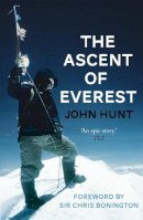
Paperback. When Sir Edmund Hillary and Sherpa Tenzing Norgay stepped onto the summit of Mount Everest on 29 May 1953 they caught the imagination of the world in a way that was to be unmatched until man stood on the surface of the Moon. Num Pages: 336 pages, 2x8pp b&w. BIC Classification: 1FKAH; 3JJPG; WSBX; WSZG. Category: (G) General (US: Trade). Dimension: 197 x 132 x 22. Weight in Grams: 252.
- Format
- Paperback
- Publication date
- 2013
- Publisher
- Hodder & Stoughton
- Number of pages
- 320
- Condition
- New
- SKU
- V9781444760897
- ISBN
- 9781444760897
Paperback
Condition: New
€ 19.99€ 14.50
€ 19.99
€ 14.50
Sheet map, folded. OS Explorer is the Ordnance Survey's most detailed map and is recommended for anyone enjoying outdoor activities like walking, horse riding and off-road cycling. Providing complete GB coverage the series details essential information such as youth hostels, pubs and visitor information as well as rights of way, permissive paths and bridleways. Series: OS Explorer Map. BIC Classification: 1DBKESX; WSZC; WTRM. Category: (G) General (US: Trade). Dimension: 135 x 241 x 77. Weight in Grams: 130.
- Publisher
- Ordnance Survey
- Publication date
- 2015
- Edition
- May 2015 ed
- Condition
- New
- SKU
- V9780319242490
- ISBN
- 9780319242490
Paperback
Condition: New
€ 17.99€ 13.95
€ 17.99
€ 13.95
.
- Publisher
- Ordnance Survey
- Publication date
- 2015
- Edition
- May 2015 ed
- Condition
- New
- SKU
- V9780319469286
- ISBN
- 9780319469286
Paperback
Condition: New
€ 21.99€ 17.07
€ 21.99
€ 17.07
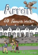
Paperback. With dramatic mountain ridges towering over the moorland of its northern half, and a lusher, softer landscape in the south, Arran is often dubbed as Scotland in Miniature. The fact is that this is an island with a huge amount to offer packed into small space. This book deals with Arran. Series: Pocket Mountains S. Num Pages: 96 pages, full colour illustrations throughout. BIC Classification: 1DBKSH; WSZC; WTH. Category: (G) General (US: Trade). Dimension: 148 x 148 x 7. Weight in Grams: 128. 40 Favourite Walks. Series: Pocket Mountains S. 96 pages, full colour illustrations throughout. With dramatic mountain ridges towering over the moorland of its northern half, and a lusher, softer landscape in the south, Arran is often dubbed as Scotland in Miniature. The fact is that this is an island with a huge amount to offer packed into small space. This book deals with Arran. Cateogry: (G) General (US: Trade). BIC Classification: 1DBKSH; WSZC; WTH. Dimension: 148 x 148 x 7. Weight: 128.
- Publisher
- Pocket Mountains
- Number of pages
- 96
- Format
- Paperback
- Publication date
- 2012
- Condition
- New
- SKU
- V9781907025327
- ISBN
- 9781907025327
Paperback
Condition: New
€ 10.03
€ 10.03
Sheet map, folded. .
- Publisher
- Harvey Map Services Ltd
- Publication date
- 2016
- Condition
- New
- SKU
- V9781851375882
- ISBN
- 9781851375882
Paperback
Condition: New
€ 16.38
€ 16.38
Sheet map, folded. BIC Classification: WSZC; WTRM. Category: (G) General (US: Trade). Dimension: 245 x 114 x 4. Weight in Grams: 72.
- Publisher
- Harvey Map Services Ltd
- Publication date
- 2014
- Condition
- New
- SKU
- V9781851375264
- ISBN
- 9781851375264
Paperback
Condition: New
€ 20.75
€ 20.75
Paperback. Deals with the Pendle district in East Lancashire. This title features twenty walks that use starting points such as Barley, Wycoller, Foulridge and Trawden. It covers places such as the iconic Pendle Hill, Newchurch, Boulsworth Hill and the Leeds-Liverpool Canal. Series: Walking Country S. Num Pages: 48 pages, 20 full colour photos. BIC Classification: WSZC. Category: (G) General (US: Trade). Dimension: 149 x 105 x 5. Weight in Grams: 50. Short Scenic Walks. Series: Walking Country S. 48 pages, 20 full colour photos. Deals with the Pendle district in East Lancashire. This title features twenty walks that use starting points such as Barley, Wycoller, Foulridge and Trawden. It covers places such as the iconic Pendle Hill, Newchurch, Boulsworth Hill and the Leeds-Liverpool Canal. Cateogry: (G) General (US: Trade). BIC Classification: WSZC. Dimension: 149 x 105 x 5. Weight: 50.
- Publisher
- Hillside Publications
- Number of pages
- 48
- Format
- Paperback
- Publication date
- 2010
- Condition
- New
- SKU
- V9781907626029
- ISBN
- 9781907626029
Paperback
Condition: New
€ 7.76
€ 7.76
Sheet map, folded. .
- Publisher
- Ordnance Survey
- Publication date
- 2015
- Edition
- September 2015 ed
- Condition
- New
- SKU
- V9780319472538
- ISBN
- 9780319472538
Paperback
Condition: New
€ 21.99€ 17.05
€ 21.99
€ 17.05

