Travel maps & atlases
Results 1321 - 1329 of 1329
Travel maps & atlases
Sheet map, folded. .
- Publisher
- Ordnance Survey
- Publication date
- 2016
- Edition
- February 2016 ed
- Condition
- New
- SKU
- V9780319262337
- ISBN
- 9780319262337
Condition: New
€ 16.99€ 13.91
€ 16.99
€ 13.91
Sheet map, folded. .
- Publisher
- Ordnance Survey
- Publication date
- 2016
- Edition
- February 2016 ed
- Condition
- New
- SKU
- V9780319474587
- ISBN
- 9780319474587
Condition: New
€ 21.99€ 17.22
€ 21.99
€ 17.22
Sheet map, folded. .
- Publisher
- Ordnance Survey
- Publication date
- 2015
- Edition
- September 2015 ed
- Condition
- New
- SKU
- V9780319246412
- ISBN
- 9780319246412
Condition: New
€ 16.99€ 13.91
€ 16.99
€ 13.91
Sheet map, folded. .
- Publisher
- Ordnance Survey
- Publication date
- 2015
- Edition
- September 2015 ed
- Condition
- New
- SKU
- V9780319472613
- ISBN
- 9780319472613
Condition: New
€ 21.99€ 17.21
€ 21.99
€ 17.21
Paperback. Num Pages: 104 pages. BIC Classification: 1DBKEML; WTRS. Category: (G) General (US: Trade). Dimension: 217 x 150 x 6. Weight in Grams: 172.
- Publisher
- Geographers a-Z
- Format
- Paperback
- Publication date
- 2015
- Edition
- 8th Edition
- Condition
- New
- SKU
- V9781782570844
- ISBN
- 9781782570844
Paperback
Condition: New
€ 7.99€ 7.51
€ 7.99
€ 7.51
Sheet map. Series: Insight Travel Maps. BIC Classification: 1DSE; WTRM. Category: (G) General (US: Trade). .
- Publisher
- Insight Guides Travel Map Andalucia & Costa del Sol
- Publication date
- 2017
- Edition
- 3rd Revised edition
- Condition
- New
- SKU
- V9781786719003
- ISBN
- 9781786719003
Paperback
Condition: New
€ 6.16
€ 6.16
Sheet map. Series: Insight Travel Maps. BIC Classification: 1DDF; WTM; WTRM. Category: (G) General (US: Trade). Dimension: 129 x 294 x 31. Weight in Grams: 148.
- Publisher
- Insight Guides Travel Map Northern France
- Publication date
- 2016
- Edition
- 5th Edition
- Condition
- New
- SKU
- V9781780055091
- ISBN
- 9781780055091
Paperback
Condition: New
€ 8.43
€ 8.43
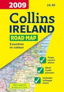
Sheet map, folded. Full colour map of Ireland at 9 miles to 1 inch (1:570,240), with clear, detailed road network and counties and administrative areas shown in colour. Num Pages: With index. BIC Classification: 1DBR; WTR. Category: (G) General (US: Trade). Dimension: 245 x 140. Weight in Grams: 79.
- Condition
- Used, Like New
- Publisher
- HarperCollins Publishers Cheltenham
- Publication date
- 2008
- Edition
- New edition
- SKU
- KRS0003573
- ISBN
- 9780007272518
Paperback
Condition: Used, Like New
€ 4.99
€ 4.99
Paperback. Addresses geographical issues by establishing its presentation of the region, with core political and physical maps, including 20 individual country maps, each with an accompanying flag and profile section. This edition includes Afghanistan, Pakistan, and Sudan. Num Pages: 128 pages, 70 colour photos, 15 black and white photos 100 maps, 50 graphs/charts. BIC Classification: 1FB; WTRM. Category: (G) General (US: Trade). Dimension: 274 x 216 x 11. Weight in Grams: 612.
- Format
- Paperback
- Publication date
- 2008
- Publisher
- National Geographic Society United States
- Edition
- 2nd Edition
- Number of pages
- 128
- Condition
- New
- SKU
- V9781426202216
- ISBN
- 9781426202216
Paperback
Condition: New
€ 23.99€ 21.86
€ 23.99
€ 21.86

