Travel maps & atlases
Results 1273 - 1296 of 1341
Travel maps & atlases
Sheet map, folded. A detailed map of Galway City and surrounding area complete with street index, places of interest and City Centre extract. Series: Irish Street Maps. BIC Classification: 1DBR; WTRS. Category: (G) General (US: Trade). Dimension: 126 x 260 x 17. Weight in Grams: 92.
- Publication date
- 2016
- Publisher
- Ordnance Survey Ireland
- Condition
- New
- SKU
- 9781908852731
- ISBN
- 9781908852731
Condition: New
€ 14.99€ 13.56
€ 14.99
€ 13.56
Sheet map, folded. Series: Irish Activity Map. Num Pages: both sides, colour. BIC Classification: 1DBKN; WSZ; WTRM. Category: (G) General (US: Trade). Dimension: 213 x 149 x 11. Weight in Grams: 146.
- Publisher
- Ordnance Survey of Northern Ireland
- Publication date
- 2008
- Condition
- New
- SKU
- V9781905306275
- ISBN
- 9781905306275
Condition: New
€ 14.99€ 14.98
€ 14.99
€ 14.98
Sheet map, folded. Series: Irish Street Maps. BIC Classification: 1DBKN; WTRS. Category: (G) General (US: Trade). Dimension: 270 x 132 x 15. Weight in Grams: 104.
- Publisher
- Ordnance Survey of Northern Ireland
- Publication date
- 2006
- Condition
- New
- SKU
- V9781905306138
- ISBN
- 9781905306138
Condition: New
€ 14.99€ 14.98
€ 14.99
€ 14.98
Sheet map, folded. Series: Irish Street Maps. BIC Classification: 1DBKN; WTRS. Category: (G) General (US: Trade). Dimension: 271 x 128 x 15. Weight in Grams: 124.
- Publisher
- Ordnance Survey of Northern Ireland
- Publication date
- 2008
- Condition
- New
- SKU
- V9781905306282
- ISBN
- 9781905306282
Condition: New
€ 14.99€ 14.98
€ 14.99
€ 14.98
Sheet map, folded. Series: Irish Discoverer Series. BIC Classification: 1DBKN; WTRD. Category: (G) General (US: Trade). Dimension: 170 x 116 x 13. Weight in Grams: 80.
- Publication date
- 2012
- Publisher
- Land & Property Services
- Condition
- New
- SKU
- KTG0021737
- ISBN
- 9781905306633
Condition: New
€ 14.99€ 4.99
€ 14.99
€ 4.99
Sheet map, folded. The Lough Erne Activity map has recently received the Gold award for best map at the International Map Trade Association awards. Series: Irish Activity Map. BIC Classification: 1DBKN; WSZ; WTRM. Category: (G) General (US: Trade). Dimension: 213 x 155 x 12. Weight in Grams: 146.
- Publication date
- 2008
- Publisher
- Land & Property Services
- Condition
- New
- SKU
- 9781905306268
- ISBN
- 9781905306268
Condition: New
€ 17.95
€ 17.95
Sheet map. Series: Crumpled City Map. Num Pages: 1 pages. BIC Classification: 1DDN; WTRS. Category: (G) General (US: Trade). Dimension: 153 x 124 x 26. Weight in Grams: 32.
- Publisher
- Palomar Italy
- Number of pages
- 1
- Publication date
- 2011
- Edition
- 01st Edition
- Condition
- New
- SKU
- V9788890573279
- ISBN
- 9788890573279
Condition: New
€ 13.99€ 11.33
€ 13.99
€ 11.33
Sheet map, folded. BIC Classification: 1FPCH; 1FPCM; WTRM. Category: (G) General (US: Trade). Dimension: 251 x 113 x 8. Weight in Grams: 70.
- Publisher
- Periplus Editions (HK) ltd.
- Publication date
- 2013
- Edition
- 6th Revised edition
- Condition
- New
- SKU
- V9780794607111
- ISBN
- 9780794607111
Condition: New
€ 9.99€ 9.69
€ 9.99
€ 9.69
Num Pages: 1 pages, maps. BIC Classification: 1FMM; WTRM. Category: (G) General (US: Trade). Dimension: 117 x 261 x 3. Weight in Grams: 62.
- Publication date
- 2013
- Publisher
- Periplus Editions (HK) ltd.
- Edition
- 3rd edition
- Number of pages
- 1
- Condition
- New
- SKU
- V9780794607272
- ISBN
- 9780794607272
Condition: New
€ 9.99€ 9.69
€ 9.99
€ 9.69
Sheet map, folded. Num Pages: 7 Area Maps; 6 City Plans. BIC Classification: 1FMN; WTRM. Category: (G) General (US: Trade). Dimension: 260 x 77 x 3. Weight in Grams: 70.
- Publisher
- Periplus Editions United States
- Publication date
- 2012
- Edition
- 5th Edition, Fifth Edition
- Condition
- New
- SKU
- V9780794607005
- ISBN
- 9780794607005
Condition: New
€ 9.99€ 9.66
€ 9.99
€ 9.66
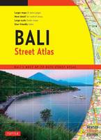
Paperback. Num Pages: 144 pages. BIC Classification: 1FMNB; WTRS. Category: (G) General (US: Trade). Dimension: 272 x 199 x 8. Weight in Grams: 384.
- Publisher
- Tuttle Publishing
- Format
- Paperback
- Publication date
- 2015
- Edition
- 4th Edition
- Condition
- New
- SKU
- V9780804845298
- ISBN
- 9780804845298
Paperback
Condition: New
€ 19.99€ 14.43
€ 19.99
€ 14.43
Sheet map, folded. Num Pages: 6 city plans; 6 area maps. BIC Classification: 1FPJ; WTR. Category: (G) General (US: Trade). Dimension: 113 x 261 x 8. Weight in Grams: 70.
- Publisher
- Tuttle Publishing
- Publication date
- 2015
- Edition
- Bilingual
- Condition
- New
- SKU
- V9784805313381
- ISBN
- 9784805313381
Paperback
Condition: New
€ 9.99€ 9.57
€ 9.99
€ 9.57
Sheet map, folded. Num Pages: 8 city plans; 4 area maps. BIC Classification: 1FMT; WTR. Category: (G) General (US: Trade). Dimension: 262 x 112 x 8. Weight in Grams: 102.
- Publisher
- Periplus Editions (HK) ltd.
- Publication date
- 2015
- Edition
- 7th Revised edition
- Condition
- New
- SKU
- V9780794607081
- ISBN
- 9780794607081
Paperback
Condition: New
€ 10.99€ 9.19
€ 10.99
€ 9.19
Sheet map, folded. Num Pages: 5 city plans, 4 area maps. BIC Classification: 1FPC; WTRM. Category: (G) General (US: Trade). Dimension: 263 x 111 x 10. Weight in Grams: 72.
- Publisher
- Periplus Editions (HK) ltd.
- Publication date
- 2015
- Edition
- 8th ed.
- Condition
- New
- SKU
- V9780794607715
- ISBN
- 9780794607715
Paperback
Condition: New
€ 9.99€ 9.69
€ 9.99
€ 9.69
Sheet map, folded. Num Pages: 5 city plans; 8 area maps. BIC Classification: 1MBF; WTRM. Category: (G) General (US: Trade). Dimension: 112 x 262 x 9. Weight in Grams: 70.
- Publisher
- Periplus Editions (HK) ltd.
- Publication date
- 2015
- Edition
- 6th Edition
- Condition
- New
- SKU
- V9780794607685
- ISBN
- 9780794607685
Paperback
Condition: New
€ 9.99€ 9.69
€ 9.99
€ 9.69
Sheet map, folded. Num Pages: colour illustrations, maps. BIC Classification: 1FMM; WTRM. Category: (G) General (US: Trade). Dimension: 260 x 83 x 5. Weight in Grams: 70.
- Publisher
- Periplus Editions United States
- Publication date
- 2012
- Edition
- 7 Map
- Condition
- New
- SKU
- V9780794607043
- ISBN
- 9780794607043
Paperback
Condition: New
€ 10.99€ 9.19
€ 10.99
€ 9.19
Sheet map, folded. Num Pages: 1 Area Map; 5 City Plans. BIC Classification: 1FMB; WTR. Category: (G) General (US: Trade). Dimension: 261 x 116 x 7. Weight in Grams: 74.
- Publisher
- Periplus Editions (HK) ltd.
- Publication date
- 2014
- Edition
- 4th Edition
- Condition
- New
- SKU
- V9780794607623
- ISBN
- 9780794607623
Paperback
Condition: New
€ 9.99€ 9.71
€ 9.99
€ 9.71
Sheet map, folded. Num Pages: 4 Area Maps; 2 City Plans. BIC Classification: 1FMN; 1FMNB; WTRM. Category: (G) General (US: Trade). Dimension: 249 x 112 x 7. Weight in Grams: 72.
- Publisher
- Periplus Editions (HK) ltd.
- Publication date
- 2013
- Edition
- 4th ed.
- Condition
- New
- SKU
- V9780794607425
- ISBN
- 9780794607425
Paperback
Condition: New
€ 9.99€ 9.69
€ 9.99
€ 9.69
Hardcover. The years between the end of the American Revolution and the beginning of the Civil War were crucial ones in the history of American coastal charting. This volume contains these navigational charts, as well as a detailed look at the hydrographers and companies who produced them. Num Pages: 272 pages, 140 charts. BIC Classification: 1KBB; 3JF; 3JH; WC; WTRM. Category: (G) General (US: Trade). Dimension: 312 x 234 x 24. Weight in Grams: 1526.
- Publisher
- Schiffer Publishing
- Format
- Hardback
- Publication date
- 1999
- Edition
- First Edition
- Condition
- New
- SKU
- V9780887400193
- ISBN
- 9780887400193
Hardback
Condition: New
€ 61.99€ 44.66
€ 61.99
€ 44.66
.
- Publisher
- Alan Godfrey Maps United Kingdom
- Publication date
- 1987
- Edition
- Facsimile
- Condition
- New
- SKU
- V9780850540970
- ISBN
- 9780850540970
Hardback
Condition: New
€ 6.91
€ 6.91
Paperback. "The Cotswold Town and Village Guide": The latest fully updated edition of the "Definitive Guide to Places of Interest in the Cotswolds" as the author says this is the result of my continuing love affair with the Cotswolds, an area that he has known for most of his life. Editor(s): Reardon, Nicholas. Series: Driveabout. Num Pages: 172 pages, Photographs. BIC Classification: 1DBKEWG; WTH; WTR. Category: (G) General (US: Trade). Dimension: 220 x 160 x 16. Weight in Grams: 508.
- Publisher
- Reardon Publishing United Kingdom
- Number of pages
- 172
- Format
- Paperback
- Publication date
- 2014
- Edition
- 5th Revised edition
- Condition
- New
- SKU
- V9781874192787
- ISBN
- 9781874192787
Paperback
Condition: New
€ 18.13
€ 18.13
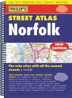
Spiral bound. A fully updated edition of this spiral-bound Philip's street atlas of Norfolk, giving detailed coverage of the region. The atlas is suitable for both business and leisure use. BIC Classification: 1DBKEAN; WTRS. Category: (G) General (US: Trade). Dimension: 272 x 197 x 18. Weight in Grams: 430.
- Publisher
- Octopus Publishing Group
- Format
- Paperback
- Publication date
- 2016
- Edition
- UK ed.
- Condition
- New
- SKU
- V9781849074285
- ISBN
- 9781849074285
Paperback
Condition: New
€ 19.99€ 14.50
€ 19.99
€ 14.50
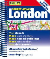
Spiral bound. A new edition of this handy mini spiral format that fits easily into a pocket, briefcase or handbag. This detailed colour mini street atlas covers all of London from Richmond to Greenwich and from Highgate to Streatham, with enlarged maps of central London from Earl's Court to Tower Bridge. Series: Philip's Street Atlases. Num Pages: 320 pages, colour maps. BIC Classification: 1DBKESL; WTRS. Category: (G) General (US: Trade). Dimension: 146 x 120 x 20. Weight in Grams: 224.
- Publisher
- Octopus Publishing Group
- Format
- Spiralbound
- Publication date
- 2012
- Condition
- New
- SKU
- KRS0029196
- ISBN
- 9781849072083
Spiralbound
Condition: New
€ 4.99
€ 4.99
Spiral bound. Philip's Big Road Atlas Britain and Ireland 2017 is a large-format spiral-bound atlas featuring fully updated maps from the Philip's digital database, which has been voted Britain's clearest and most detailed in an independent consumer survey. Num Pages: 168 pages. BIC Classification: 1DBK; 1DBR; WTRD. Category: (G) General (US: Trade). Dimension: 296 x 397 x 15. Weight in Grams: 956.
- Publisher
- Octopus Publishing Group
- Format
- Spiralbound
- Publication date
- 2016
- Condition
- New
- SKU
- KTG0016199
- ISBN
- 9781849074155
Spiralbound
Condition: New
€ 4.99
€ 4.99

