Travel maps & atlases
Results 49 - 72 of 1319
Travel maps & atlases
.
- Publisher
- Alan Godfrey Maps United Kingdom
- Publication date
- 1987
- Edition
- Facsimile
- Condition
- New
- SKU
- V9780850540970
- ISBN
- 9780850540970
Condition: New
€ 6.91
€ 6.91
Hardcover. The years between the end of the American Revolution and the beginning of the Civil War were crucial ones in the history of American coastal charting. This volume contains these navigational charts, as well as a detailed look at the hydrographers and companies who produced them. Num Pages: 272 pages, 140 charts. BIC Classification: 1KBB; 3JF; 3JH; WC; WTRM. Category: (G) General (US: Trade). Dimension: 312 x 234 x 24. Weight in Grams: 1526.
- Publisher
- Schiffer Publishing
- Format
- Hardback
- Publication date
- 1999
- Edition
- First Edition
- Condition
- New
- SKU
- V9780887400193
- ISBN
- 9780887400193
Hardback
Condition: New
€ 62.05€ 44.66
€ 62.05
€ 44.66
Sheet map, folded. Num Pages: 4 Area Maps; 2 City Plans. BIC Classification: 1FMN; 1FMNB; WTRM. Category: (G) General (US: Trade). Dimension: 249 x 112 x 7. Weight in Grams: 72.
- Publisher
- Periplus Editions (HK) ltd.
- Publication date
- 2013
- Edition
- 4th ed.
- Condition
- New
- SKU
- V9780794607425
- ISBN
- 9780794607425
Hardback
Condition: New
€ 9.99€ 9.69
€ 9.99
€ 9.69
Sheet map, folded. Num Pages: 1 Area Map; 5 City Plans. BIC Classification: 1FMB; WTR. Category: (G) General (US: Trade). Dimension: 261 x 116 x 7. Weight in Grams: 74.
- Publisher
- Periplus Editions (HK) ltd.
- Publication date
- 2014
- Edition
- 4th Edition
- Condition
- New
- SKU
- V9780794607623
- ISBN
- 9780794607623
Hardback
Condition: New
€ 9.99€ 9.71
€ 9.99
€ 9.71
Sheet map, folded. Num Pages: colour illustrations, maps. BIC Classification: 1FMM; WTRM. Category: (G) General (US: Trade). Dimension: 260 x 83 x 5. Weight in Grams: 70.
- Publisher
- Periplus Editions United States
- Publication date
- 2012
- Edition
- 7 Map
- Condition
- New
- SKU
- V9780794607043
- ISBN
- 9780794607043
Hardback
Condition: New
€ 10.99€ 9.19
€ 10.99
€ 9.19
Sheet map, folded. Num Pages: 5 city plans; 8 area maps. BIC Classification: 1MBF; WTRM. Category: (G) General (US: Trade). Dimension: 112 x 262 x 9. Weight in Grams: 70.
- Publisher
- Periplus Editions (HK) ltd.
- Publication date
- 2015
- Edition
- 6th Edition
- Condition
- New
- SKU
- V9780794607685
- ISBN
- 9780794607685
Hardback
Condition: New
€ 9.99€ 9.69
€ 9.99
€ 9.69
Sheet map, folded. Num Pages: 5 city plans, 4 area maps. BIC Classification: 1FPC; WTRM. Category: (G) General (US: Trade). Dimension: 263 x 111 x 10. Weight in Grams: 72.
- Publisher
- Periplus Editions (HK) ltd.
- Publication date
- 2015
- Edition
- 8th ed.
- Condition
- New
- SKU
- V9780794607715
- ISBN
- 9780794607715
Hardback
Condition: New
€ 9.99€ 9.69
€ 9.99
€ 9.69
Sheet map, folded. Num Pages: 8 city plans; 4 area maps. BIC Classification: 1FMT; WTR. Category: (G) General (US: Trade). Dimension: 262 x 112 x 8. Weight in Grams: 102.
- Publisher
- Periplus Editions (HK) ltd.
- Publication date
- 2015
- Edition
- 7th Revised edition
- Condition
- New
- SKU
- V9780794607081
- ISBN
- 9780794607081
Hardback
Condition: New
€ 10.99€ 9.19
€ 10.99
€ 9.19
Sheet map, folded. Num Pages: 6 city plans; 6 area maps. BIC Classification: 1FPJ; WTR. Category: (G) General (US: Trade). Dimension: 113 x 261 x 8. Weight in Grams: 70.
- Publisher
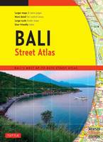
- Tuttle Publishing
- Publication date
- 2015
- Edition
- Bilingual
- Condition
- New
- SKU
- V9784805313381
- ISBN
- 9784805313381
Hardback
Condition: New
€ 9.99€ 9.57
€ 9.99
€ 9.57
Paperback. Num Pages: 144 pages. BIC Classification: 1FMNB; WTRS. Category: (G) General (US: Trade). Dimension: 272 x 199 x 8. Weight in Grams: 384.
- Publisher
- Tuttle Publishing
- Format
- Paperback
- Publication date
- 2015
- Edition
- 4th Edition
- Condition
- New
- SKU
- V9780804845298
- ISBN
- 9780804845298
Paperback
Condition: New
€ 19.99€ 14.43
€ 19.99
€ 14.43
Sheet map, folded. Num Pages: 7 Area Maps; 6 City Plans. BIC Classification: 1FMN; WTRM. Category: (G) General (US: Trade). Dimension: 260 x 77 x 3. Weight in Grams: 70.
- Publisher
- Periplus Editions United States
- Publication date
- 2012
- Edition
- 5th Edition, Fifth Edition
- Condition
- New
- SKU
- V9780794607005
- ISBN
- 9780794607005
Paperback
Condition: New
€ 9.99€ 9.66
€ 9.99
€ 9.66
Num Pages: 1 pages, maps. BIC Classification: 1FMM; WTRM. Category: (G) General (US: Trade). Dimension: 117 x 261 x 3. Weight in Grams: 62.
- Publication date
- 2013
- Publisher
- Periplus Editions (HK) ltd.
- Edition
- 3rd edition
- Number of pages
- 1
- Condition
- New
- SKU
- V9780794607272
- ISBN
- 9780794607272
Paperback
Condition: New
€ 9.99€ 9.69
€ 9.99
€ 9.69
Sheet map, folded. BIC Classification: 1FPCH; 1FPCM; WTRM. Category: (G) General (US: Trade). Dimension: 251 x 113 x 8. Weight in Grams: 70.
- Publisher
- Periplus Editions (HK) ltd.
- Publication date
- 2013
- Edition
- 6th Revised edition
- Condition
- New
- SKU
- V9780794607111
- ISBN
- 9780794607111
Paperback
Condition: New
€ 9.99€ 9.69
€ 9.99
€ 9.69
Sheet map. Series: Crumpled City Map. Num Pages: 1 pages. BIC Classification: 1DDN; WTRS. Category: (G) General (US: Trade). Dimension: 153 x 124 x 26. Weight in Grams: 32.
- Publisher
- Palomar Italy
- Number of pages
- 1
- Publication date
- 2011
- Edition
- 01st Edition
- Condition
- New
- SKU
- V9788890573279
- ISBN
- 9788890573279
Paperback
Condition: New
€ 13.99€ 11.33
€ 13.99
€ 11.33
Sheet map, folded. The Lough Erne Activity map has recently received the Gold award for best map at the International Map Trade Association awards. Series: Irish Activity Map. BIC Classification: 1DBKN; WSZ; WTRM. Category: (G) General (US: Trade). Dimension: 213 x 155 x 12. Weight in Grams: 146.
- Publication date
- 2008
- Publisher
- Land & Property Services
- Condition
- New
- SKU
- 9781905306268
- ISBN
- 9781905306268
Paperback
Condition: New
€ 17.95
€ 17.95
Sheet map, folded. Series: Irish Discoverer Series. BIC Classification: 1DBKN; WTRD. Category: (G) General (US: Trade). Dimension: 170 x 116 x 13. Weight in Grams: 80.
- Publication date
- 2012
- Publisher
- Land & Property Services
- Condition
- New
- SKU
- KTG0021737
- ISBN
- 9781905306633
Paperback
Condition: New
€ 14.99€ 4.99
€ 14.99
€ 4.99
Sheet map, folded. Series: Irish Street Maps. BIC Classification: 1DBKN; WTRS. Category: (G) General (US: Trade). Dimension: 271 x 128 x 15. Weight in Grams: 124.
- Publisher
- Ordnance Survey of Northern Ireland
- Publication date
- 2008
- Condition
- New
- SKU
- V9781905306282
- ISBN
- 9781905306282
Paperback
Condition: New
€ 14.99€ 14.98
€ 14.99
€ 14.98
Sheet map, folded. Series: Irish Street Maps. BIC Classification: 1DBKN; WTRS. Category: (G) General (US: Trade). Dimension: 270 x 132 x 15. Weight in Grams: 104.
- Publisher
- Ordnance Survey of Northern Ireland
- Publication date
- 2006
- Condition
- New
- SKU
- V9781905306138
- ISBN
- 9781905306138
Paperback
Condition: New
€ 14.99€ 14.98
€ 14.99
€ 14.98
Sheet map, folded. Series: Irish Activity Map. Num Pages: both sides, colour. BIC Classification: 1DBKN; WSZ; WTRM. Category: (G) General (US: Trade). Dimension: 213 x 149 x 11. Weight in Grams: 146.
- Publisher
- Ordnance Survey of Northern Ireland
- Publication date
- 2008
- Condition
- New
- SKU
- V9781905306275
- ISBN
- 9781905306275
Paperback
Condition: New
€ 14.99€ 14.98
€ 14.99
€ 14.98
Sheet map, folded. A detailed map of Galway City and surrounding area complete with street index, places of interest and City Centre extract. Series: Irish Street Maps. BIC Classification: 1DBR; WTRS. Category: (G) General (US: Trade). Dimension: 126 x 260 x 17. Weight in Grams: 92.
- Publication date
- 2016
- Publisher
- Ordnance Survey Ireland
- Condition
- New
- SKU
- 9781908852731
- ISBN
- 9781908852731
Paperback
Condition: New
€ 14.99€ 13.56
€ 14.99
€ 13.56
Paperback. Series: Irish Discovery Series. BIC Classification: 1DBR; WSZC; WTRM. Category: (G) General (US: Trade). Dimension: 204 x 180 x 7. Weight in Grams: 74.
- Format
- Paperback
- Publication date
- 2011
- Publisher
- Ordnance Survey Ireland
- Condition
- New
- SKU
- KKE0000912
- ISBN
- 9781907122569
Paperback
Condition: New
€ 4.99
€ 4.99
Paperback. Series: Irish Discovery Series. BIC Classification: 1DBR; WTRM. Category: (G) General (US: Trade). Dimension: 192 x 113 x 7. Weight in Grams: 72.
- Format
- Paperback
- Publication date
- 2013
- Publisher
- Ordnance Survey Ireland
- Condition
- New
- SKU
- KCW0018452
- ISBN
- 9781907122903
Paperback
Condition: New
€ 4.99
€ 4.99
Paperback. Series: Irish Discovery Series. BIC Classification: 1DBR; WSZC; WTRM. Category: (G) General (US: Trade). Dimension: 204 x 180 x 7. Weight in Grams: 74.
- Format
- Paperback
- Publication date
- 2011
- Publisher
- Ordnance Survey Ireland
- Condition
- New
- SKU
- KCW0018449
- ISBN
- 9781907122569
Paperback
Condition: New
€ 4.99
€ 4.99
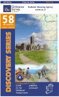
Sheet map, folded. The Discovery Series are designed for tourist and leisure activities. Each one covers an area of 40km x 30km at the scale of 1:50,000. There are 93 sheets in the series. 75 are produced by Ordnance Survey Ireland and 18 by Ordnance Survey Northern Ireland. The maps produced by Ordnance Survey Northern Ireland are called the Discoverer Series. Series: Discovery Series. BIC Classification: 1DBR; WTRM. Category: (G) General (US: Trade). Dimension: 112 x 190 x 11. Weight in Grams: 76.
- Publication date
- 2015
- Publisher
- Ordnance Survey Ireland
- Condition
- New
- SKU
- 9781908852328
- ISBN
- 9781908852328
Paperback
Condition: New
€ 8.99€ 8.61
€ 8.99
€ 8.61

