Geographical information systems (GIS) & remote sensing
Results 81 - 91 of 91
Geographical information systems (GIS) & remote sensing
Paperback. Num Pages: 293 pages, illustrations. BIC Classification: RGC; RGV; RGW. Category: (G) General (US: Trade); (U) Tertiary Education (US: College). Dimension: 180 x 254 x 18. Weight in Grams: 814.
- Publisher
- Guilford Publications
- Format
- Paperback
- Publication date
- 2016
- Edition
- 3rd Edition
- Condition
- New
- SKU
- V9781462509980
- ISBN
- 9781462509980
Paperback
Condition: New
€ 61.79
€ 61.79
Paperback. Remote sensing describes the technique of collecting information from a distance. This book describes the ways that remotely sensed data from research on biodiversity and its conservation can be captured and used, especially for evaluating human impacts on ecological systems. Series: Techniques in Ecology and Conservation. Num Pages: 496 pages, 150 illustrations in full colour. BIC Classification: RGW; RNC; RNK. Category: (P) Professional & Vocational; (U) Tertiary Education (US: College). Dimension: 234 x 156 x 23. Weight in Grams: 828.
- Publisher
- Oxford University Press United Kingdom
- Number of pages
- 496
- Format
- Paperback
- Publication date
- 2010
- Edition
- 1st Edition
- Condition
- New
- SKU
- V9780199219957
- ISBN
- 9780199219957
Paperback
Condition: New
€ 113.18
€ 113.18
Paperback. .
- Publisher
- Manning Publications
- Format
- Paperback
- Publication date
- 2015
- Edition
- 2nd Edition
- Condition
- New
- SKU
- V9781617291395
- ISBN
- 9781617291395
Paperback
Condition: New
€ 60.61
€ 60.61
Paperback. Principles of Geographical Information Systems provides a thorough, broad-ranging account of the theory and practice of GIS. It explains why spatial data and the information systems based on them are so important in the modern world for solving a range of practical problems. Num Pages: 352 pages, Illustrations. BIC Classification: RGW. Category: (P) Professional & Vocational; (UP) Postgraduate, Research & Scholarly; (UU) Undergraduate. Dimension: 266 x 197 x 18. Weight in Grams: 750.
- Publisher
- Oxford University Press
- Format
- Paperback
- Publication date
- 2015
- Edition
- 3rd Edition
- Condition
- New
- SKU
- V9780198742845
- ISBN
- 9780198742845
Paperback
Condition: New
€ 74.39
€ 74.39
Paperback.
Effective use of today s vast geographic information (GI) resources requires more than just powerful technology for problem solving. It requires science to help us understand the way the world works, and to help us devise effective procedures for making decisions. Num Pages: 496 pages. BIC Classification: RGW. Category: (P) Professional & Vocational. Dimension: 281 x 218 x 22. Weight in Grams: 1124.
- Publisher
- John Wiley & Sons Inc
- Format
- Paperback
- Publication date
- 2015
- Edition
- 4th Edition
- Condition
- New
- SKU
- V9781118676950
- ISBN
- 9781118676950
Paperback
Condition: New
€ 279.62
€ 279.62
Paperback. A quantitative yet accessible introduction to remote sensing techniques, this new edition covers a broad spectrum of Earth science applications. Num Pages: 460 pages, 323 b/w illus. 40 colour illus. BIC Classification: RGW; TTB. Category: (P) Professional & Vocational; (U) Tertiary Education (US: College). Dimension: 244 x 190 x 23. Weight in Grams: 1066. 460 pages, 323 b/w illus. 40 colour illus. A quantitative yet accessible introduction to remote sensing techniques, this new edition covers a broad spectrum of Earth science applications. Cateogry: (P) Professional & Vocational; (U) Tertiary Education (US: College). BIC Classification: RGW; TTB. Dimension: 244 x 190 x 23. Weight: 1054.
- Publisher
- Cambridge University Press
- Number of pages
- 460
- Format
- Paperback
- Publication date
- 2012
- Edition
- 3rd Edition
- Condition
- New
- SKU
- V9780521181167
- ISBN
- 9780521181167
Paperback
Condition: New
€ 116.80
€ 116.80
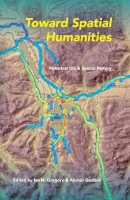
Paperback. The application of Geographic Information Systems (GIS) to issues in history is among the most exciting developments in both digital and spatial humanities. Describing a variety of applications, this book includes essays that highlight the methodological and substantive implications of a spatial approach to history. Editor(s): Gregory, Ian N.; Geddes, Alistair. Series: The Spatial Humanities. Num Pages: 234 pages, 46 b 4 tables. BIC Classification: HBAH; RGW. Category: (P) Professional & Vocational. Dimension: 154 x 231 x 13. Weight in Grams: 354.
- Publisher
- Indiana University Press
- Format
- Paperback
- Publication date
- 2014
- Condition
- New
- SKU
- V9780253011862
- ISBN
- 9780253011862
Paperback
Condition: New
€ 40.20
€ 40.20
Paperback. Num Pages: 336 pages. BIC Classification: PDR; RGW. Category: (G) General (US: Trade); (P) Professional & Vocational; (U) Tertiary Education (US: College). Dimension: 198 x 129. .
- Publisher
- Granta Books
- Format
- Paperback
- Publication date
- 2017
- Condition
- New
- SKU
- V9781847087096
- ISBN
- 9781847087096
Paperback
Condition: New
€ 13.99€ 10.55
€ 13.99
€ 10.55
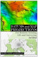
Paperback. A practical guide to coordinate reference systems. Num Pages: 224 pages, liberally illustrated with full colour. BIC Classification: RGV; RGW; RGY. Category: (P) Professional & Vocational; (U) Tertiary Education (US: College). Dimension: 156 x 235 x 14. Weight in Grams: 482.
- Publisher
- Whittles Publishing United Kingdom
- Number of pages
- 224
- Format
- Paperback
- Publication date
- 2008
- Edition
- 2Rev Ed
- Condition
- New
- SKU
- V9781904445470
- ISBN
- 9781904445470
Paperback
Condition: New
€ 55.47
€ 55.47
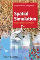
Paperback. A ground-up approach to explaining dynamic spatial modelling for an interdisciplinary audience. Num Pages: 330 pages, maps, figures, colour plates. BIC Classification: RGW. Category: (P) Professional & Vocational. Dimension: 170 x 245 x 16. Weight in Grams: 522.
- Publisher
- John Wiley & Sons Inc United States
- Number of pages
- 330
- Format
- Paperback
- Publication date
- 2013
- Edition
- 1st Edition
- Condition
- New
- SKU
- V9781119970798
- ISBN
- 9781119970798
Paperback
Condition: New
€ 85.89
€ 85.89
Hardback. .
- Publisher
- Taylor & Francis Inc
- Format
- Hardback
- Publication date
- 2017
- Edition
- 1st Edition
- Condition
- New
- SKU
- V9781466510081
- ISBN
- 9781466510081
Hardback
Condition: New
€ 124.18
€ 124.18


