Geographical information systems (GIS) & remote sensing
Results 41 - 60 of 93
Geographical information systems (GIS) & remote sensing
Paperback. Num Pages: 192 pages, 30 b/w photos. BIC Classification: RGW; UDH. Category: (G) General (US: Trade). Dimension: 209 x 140 x 13. Weight in Grams: 226.
- Format
- Paperback
- Publication date
- 2008
- Publisher
- Burford Books,U.S. United States
- Edition
- Revised, Updated
- Number of pages
- 192
- Condition
- New
- SKU
- V9781580801492
- ISBN
- 9781580801492
Paperback
Condition: New
€ 16.99€ 16.07
€ 16.99
€ 16.07
Hardback. Editor(s): Samuelson, Robert J.; Mata, Marlin. Num Pages: 148 pages, illustrations. BIC Classification: JWK; RGW. Category: (P) Professional & Vocational; (UP) Postgraduate, Research & Scholarly; (UU) Undergraduate. Dimension: 236 x 158 x 15. Weight in Grams: 366.
- Publisher
- Nova Science Publishers Inc United States
- Number of pages
- 148
- Format
- Hardback
- Publication date
- 2012
- Edition
- UK ed.
- Condition
- New
- SKU
- V9781619425897
- ISBN
- 9781619425897
Hardback
Condition: New
€ 164.57€ 111.07
€ 164.57
€ 111.07
Hardcover. Modeling the occurrence and behaviour of groundwater is a critical aspect to any groundwater studies, whether they're being done to plan a clean-up project or in the preliminary site studies for a planned future development. This book defines what GIS is, how to perform it, and how to use GIS technology in modeling groundwater. Num Pages: 248 pages, Ill. BIC Classification: RBG; RBKF; RGW. Category: (P) Professional & Vocational; (UP) Postgraduate, Research & Scholarly; (UU) Undergraduate. Dimension: 235 x 163 x 18. Weight in Grams: 490.
- Format
- Hardback
- Publication date
- 2002
- Publisher
- John Wiley and Sons Ltd United States
- Edition
- 1st Edition
- Number of pages
- 248
- Condition
- New
- SKU
- V9780471084983
- ISBN
- 9780471084983
Hardback
Condition: New
€ 188.57
€ 188.57
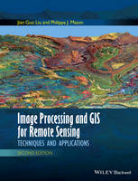
Hardcover. Following the successful publication of the 1st edition in 2009, the 2nd edition maintains its aim to provide an application-driven package of essential techniques in image processing and GIS, together with case studies for demonstration and guidance in remote sensing applications. Num Pages: 488 pages. BIC Classification: RB; RGW. Category: (P) Professional & Vocational. Dimension: 246 x 189. .
- Publisher
- John Wiley & Sons Inc
- Format
- Hardback
- Publication date
- 2016
- Edition
- 2nd Edition
- Condition
- New
- SKU
- V9781118724200
- ISBN
- 9781118724200
Hardback
Condition: New
€ 120.41
€ 120.41
Hardcover. Focusing on fundamentals and techniques, this book presents the integrated use of geotechnologies such as GIS, GPS, Digital Photogrammetry, and Visualization, along with underlying theory of GIS and GPS. Also included is discussion of instrumentation and guidelines for selecting the right device for the job. Num Pages: 280 pages, line drawings, photographs, references. BIC Classification: RGW; TN; TRLN. Category: (P) Professional & Vocational. Dimension: 236 x 161 x 18. Weight in Grams: 514.
- Format
- Hardback
- Publication date
- 2003
- Publisher
- John Wiley and Sons Ltd United States
- Edition
- 1st Edition
- Number of pages
- 280
- Condition
- New
- SKU
- V9780471244097
- ISBN
- 9780471244097
Hardback
Condition: New
€ 168.60
€ 168.60
Hardback. This book presents Internet GIS in an applied and practical manner, including an introduction to basic network architecture and application development. Information is also provided on metadata, recent open standard initiatives, and ways of assuring a current system will be compatible with future designs. Num Pages: 720 pages, Illustrations, maps. BIC Classification: RGW; UDB. Category: (P) Professional & Vocational. Dimension: 242 x 161 x 37. Weight in Grams: 1140.
- Format
- Hardback
- Publication date
- 2003
- Publisher
- John Wiley and Sons Ltd United States
- Number of pages
- 720
- Condition
- New
- SKU
- V9780471359234
- ISBN
- 9780471359234
Hardback
Condition: New
€ 197.76
€ 197.76
Paperback. An integrated approach that combines essential GIS background with a practical workbook on applying the principles in ArcGIS 10. 0 and 10. 1 Introducing Geographic Information Systems with ArcGISintegrates a broad introduction to GIS with a software-specific workbook for Esri's ArcGIS. Num Pages: 672 pages, black & white illustrations, figures. BIC Classification: RGW. Category: (P) Professional & Vocational. Dimension: 232 x 191 x 43. Weight in Grams: 1144.
- Format
- Paperback
- Publication date
- 2013
- Publisher
- John Wiley & Sons Inc United States
- Edition
- 3rd Edition
- Number of pages
- 672
- Condition
- New
- SKU
- V9781118159804
- ISBN
- 9781118159804
Paperback
Condition: New
€ 124.66
€ 124.66
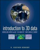
Paperback. Render three-dimensional data and maps with ease. Written as a self-study workbook, Introduction to 3D Data demystifies the sometimes confusing controls and procedures required for 3D modeling using software packages such as ArcGIS 3D Analyst and Google Earth. Num Pages: 360 pages, Illustrations. BIC Classification: RGW. Category: (P) Professional & Vocational. Dimension: 234 x 191 x 18. Weight in Grams: 606.
- Format
- Paperback
- Publication date
- 2009
- Publisher
- John Wiley and Sons Ltd United Kingdom
- Edition
- 1st Edition
- Number of pages
- 360
- Condition
- New
- SKU
- V9780470381243
- ISBN
- 9780470381243
Paperback
Condition: New
€ 92.76
€ 92.76
Hardback. .
- Publisher
- Taylor & Francis Inc
- Format
- Hardback
- Publication date
- 2017
- Edition
- 1st Edition
- Condition
- New
- SKU
- V9781466510081
- ISBN
- 9781466510081
Hardback
Condition: New
€ 124.18
€ 124.18
Hardcover. Offers professionals and students an easy-to-understand treatment of this important technology. This edition includes a chapter on GPS satellite orbit and coverage of issues, such as precise point positioning and location based services. It addresses various aspects of the GPS, emphasizes GPS applications, and examines the GPS signal structure. Num Pages: 210 pages, Illustrations,. BIC Classification: RGW; TJK. Category: (P) Professional & Vocational. Dimension: 234 x 155 x 18. Weight in Grams: 434.
- Format
- Hardback
- Publication date
- 2006
- Publisher
- Artech House United Kingdom
- Edition
- 2nd Edition
- Number of pages
- 210
- Condition
- New
- SKU
- V9781596930162
- ISBN
- 9781596930162
Hardback
Condition: New
€ 97.00
€ 97.00
Hardcover. Editors and contributors are experts in the field of kernel methods (KMs) for remote sensing. Provides state of the art knowledge, analysing the methodological and practical challenges related to the application of KMs to remote sensing problems. Editor(s): Camps-Valls, Gustavo; Bruzzone, Lorenzo. Num Pages: 434 pages, Illustrations. BIC Classification: RGW. Category: (P) Professional & Vocational. Dimension: 248 x 176 x 29. Weight in Grams: 932.
- Format
- Hardback
- Publication date
- 2009
- Publisher
- John Wiley & Sons Inc United Kingdom
- Edition
- 1st Edition
- Number of pages
- 434
- Condition
- New
- SKU
- V9780470722114
- ISBN
- 9780470722114
Hardback
Condition: New
€ 161.49
€ 161.49
Paperback. Examines the ways in which Geographical Information Systems can be used to explore archaeological landscapes, and summarises the most appropriate methods to use. This title explores the applications of GIS to a wide variety of archaeological evidence including maps, aerial photographs and earthworks. Num Pages: 240 pages, Illustrations (some col.). BIC Classification: HDW; RGW. Category: (P) Professional & Vocational; (UP) Postgraduate, Research & Scholarly; (UU) Undergraduate. Dimension: 248 x 171 x 15. Weight in Grams: 536.
- Publisher
- The History Press Ltd United Kingdom
- Number of pages
- 240
- Format
- Paperback
- Publication date
- 2006
- Condition
- New
- SKU
- V9780752436036
- ISBN
- 9780752436036
Paperback
Condition: New
€ 35.99€ 26.52
€ 35.99
€ 26.52
Hardcover. Recent advances in lasers and measuring devices, as well as new capabilities in automated data acquisition, have made possible the design and practical implementation of self-sufficient lidar systems. Series: Wiley Series in Lasers & Applications. Num Pages: 256 pages, Ill. BIC Classification: RBKC; RGW; TTBL. Category: (P) Professional & Vocational; (UP) Postgraduate, Research & Scholarly; (UU) Undergraduate. Dimension: 245 x 163 x 22. Weight in Grams: 568.
- Format
- Hardback
- Publication date
- 2001
- Publisher
- John Wiley and Sons Ltd United States
- Edition
- 1st Edition
- Number of pages
- 256
- Condition
- New
- SKU
- V9780471389279
- ISBN
- 9780471389279
Hardback
Condition: New
€ 266.11
€ 266.11
Hardcover. Many types of linear position sensors are used in commercial, industrial, and automotive products and equipment. This book explains the theory behind the various technologies used and shows how they are implemented in practice. Num Pages: 184 pages, Illustrations. BIC Classification: RGW; TG; TJF. Category: (P) Professional & Vocational. Dimension: 237 x 166 x 16. Weight in Grams: 418.
- Format
- Hardback
- Publication date
- 2003
- Publisher
- John Wiley and Sons Ltd United States
- Edition
- 1st Edition
- Number of pages
- 184
- Condition
- New
- SKU
- V9780471233268
- ISBN
- 9780471233268
Hardback
Condition: New
€ 190.09
€ 190.09
Paperback. Num Pages: 293 pages, illustrations. BIC Classification: RGC; RGV; RGW. Category: (G) General (US: Trade); (U) Tertiary Education (US: College). Dimension: 180 x 254 x 18. Weight in Grams: 814.
- Publisher
- Guilford Publications
- Format
- Paperback
- Publication date
- 2016
- Edition
- 3rd Edition
- Condition
- New
- SKU
- V9781462509980
- ISBN
- 9781462509980
Paperback
Condition: New
€ 63.79
€ 63.79
Hardcover. Satellites are able to gather a wide variety of data for earth scientists. This book presents both the theory and practical applications of remote sensing satellite data to geological problems. The applications include: mineral explorations, hydrocarbon exploration, stratigraphy, engineering geology, and environmental studies. Editor(s): Rencz, Andrew N.; Ryerson, Robert A. Series: Manual of Remote Sensing. Num Pages: 728 pages, Illustrationssome col.), maps. BIC Classification: RB; RGW. Category: (P) Professional & Vocational; (UP) Postgraduate, Research & Scholarly. Dimension: 263 x 180 x 47. Weight in Grams: 1614.
- Format
- Hardback
- Publication date
- 1999
- Publisher
- John Wiley and Sons Ltd United States
- Edition
- 3rd Edition
- Number of pages
- 728
- Condition
- New
- SKU
- V9780471294054
- ISBN
- 9780471294054
Hardback
Condition: New
€ 374.06
€ 374.06
Hardcover. Compiling the authors? combined decades of experience, Microwave Noncontact Motion Sensing and Analysis sheds light on microwave noncontact vital sign detection from bench-top module to CMOS integrated microchip, covering a frequency range of over 30 GHz. Series: Wiley Series in Microwave and Optical Engineering. Num Pages: 238 pages, illustrations. BIC Classification: RGW; TJFN; TTB. Category: (P) Professional & Vocational. Dimension: 157 x 235 x 19. Weight in Grams: 510.
- Format
- Hardback
- Publication date
- 2013
- Publisher
- John Wiley & Sons Inc United Kingdom
- Edition
- 1st Edition
- Number of pages
- 238
- Condition
- New
- SKU
- V9780470642146
- ISBN
- 9780470642146
Hardback
Condition: New
€ 174.44
€ 174.44
Hardcover. The third book in the trilogy that explores the popular missional movement From Reggie McNeal, the bestselling author of The Present Future and Missional Renaissance, comes the third book in the series that helps to define and illuminate the popular missional movement. Series: Jossey-Bass Leadership Network Series. Num Pages: 192 pages. BIC Classification: RGW; TTBM; UG. Category: (P) Professional & Vocational. Dimension: 168 x 236 x 19. Weight in Grams: 370.
- Format
- Hardback
- Publication date
- 2011
- Publisher
- John Wiley & Sons Inc United Kingdom
- Edition
- 1st Edition
- Number of pages
- 192
- Condition
- New
- SKU
- V9780470633458
- ISBN
- 9780470633458
Hardback
Condition: New
€ 32.28
€ 32.28
Paperback. Updated to reflect recent changes in ArcGIS software, this book explains how to use geodatabase structural elements to promote best practices for data modeling and powerful geographic analyses. Num Pages: 297 pages, colour illustrations, black & white tables, maps. BIC Classification: RGW. Category: (G) General (US: Trade). Dimension: 226 x 190 x 23. Weight in Grams: 816.
- Format
- Paperback
- Publication date
- 2010
- Publisher
- Esri Press
- Edition
- Second Edition, New edition
- Condition
- New
- SKU
- V9781589482784
- ISBN
- 9781589482784
Paperback
Condition: New
€ 52.99€ 52.90
€ 52.99
€ 52.90
Hardcover. Monitoring Land Supply with Geographic Information Systems Theory, Practice, and Parcel-Based Approaches Monitoring the supply of buildable land and its capacity to accommodate growth within urbanizing regions is an increasingly important component of urban planning and growth management. Editor(s): Moudon, Anne Vernez; Hubner, Michael. Num Pages: 352 pages, Ill.M. BIC Classification: RGW; RNF. Category: (P) Professional & Vocational. Dimension: 234 x 160 x 29. Weight in Grams: 686.
- Format
- Hardback
- Publication date
- 2000
- Publisher
- John Wiley and Sons Ltd United States
- Edition
- 1st Edition
- Number of pages
- 352
- Condition
- New
- SKU
- V9780471371632
- ISBN
- 9780471371632
Hardback
Condition: New
€ 214.64
€ 214.64


