Cartography, map-making & projections
Results 41 - 60 of 77
Cartography, map-making & projections
Paperback. In this work, Rick Van Noy explores the ways that four American literary cartographers - Henry David Thoreau, Clarence King, John Wesley Powell and Wallace Stegner - concerned themselves with what it means to map or survey a place and what it means to write about it. Series: Environmental Arts & Humanities S. Num Pages: 224 pages, 11 illustrations. BIC Classification: 2ABM; DSB; RGV. Category: (P) Professional & Vocational; (UP) Postgraduate, Research & Scholarly; (UU) Undergraduate. Dimension: 155 x 216 x 24. Weight in Grams: 344.
- Format
- Paperback
- Publication date
- 2003
- Publisher
- University of Nevada Press
- Condition
- New
- SKU
- V9780874175738
- ISBN
- 9780874175738
Paperback
Condition: New
€ 29.52
€ 29.52
Paperback. Num Pages: 240 pages. BIC Classification: 1KBBW; HBJK; JFS; RGC; RGV; WTH; WTL. Category: (G) General (US: Trade). Dimension: 215 x 141 x 15. Weight in Grams: 290.
- Format
- Paperback
- Publication date
- 2005
- Publisher
- University of Nevada Press
- Edition
- 1st Edition
- Condition
- New
- SKU
- V9780874176186
- ISBN
- 9780874176186
Paperback
Condition: New
€ 29.52
€ 29.52
Paperback. Explores the mathematical ideas involved in creating and analyzing maps. This book presents the famous problem of mapping the earth. Through the visual context of maps and mapmaking, it shows students how contemporary mathematics can help them to understand and explain the world. Series: Mathematical World. Num Pages: 136 pages, maps, bibliography, index. BIC Classification: PB; PHVG; RB; RGV. Category: (P) Professional & Vocational. Dimension: 254 x 177 x 8. Weight in Grams: 278.
- Format
- Paperback
- Publication date
- 2002
- Publisher
- American Mathematical Society
- Condition
- New
- SKU
- V9780821832554
- ISBN
- 9780821832554
Paperback
Condition: New
€ 71.33
€ 71.33
Paperback. A handbook for hikers on this scenic and challenging trail Series: Indiana Natural Science. Num Pages: 160 pages, 41 color illus., 24 b&w illus., 19 maps. BIC Classification: 1K; GTB; RGV. Category: (P) Professional & Vocational. Dimension: 5487 x 3556 x 11. Weight in Grams: 341.
- Format
- Paperback
- Publication date
- 2011
- Publisher
- Indiana University Press United States
- Number of pages
- 160
- Condition
- New
- SKU
- V9780253222978
- ISBN
- 9780253222978
Paperback
Condition: New
€ 21.99€ 20.83
€ 21.99
€ 20.83
paperback. A groundbreaking work on the British mapping of the Atlantic world. Series: Carleton Library Series. Num Pages: 288 pages, 78 colour maps and illustrations. BIC Classification: PDX; RGV. Category: (P) Professional & Vocational. Dimension: 6452 x 5182 x 21. Weight in Grams: 1107.
- Format
- Paperback
- Publication date
- 2011
- Publisher
- McGill-Queen's University Press Canada
- Edition
- Illustrated
- Number of pages
- 288
- Condition
- New
- SKU
- V9780773538481
- ISBN
- 9780773538481
Paperback
Condition: New
€ 58.84
€ 58.84
Scotland's Pariah is the first book to examine the remarkable life of John Pinkerton: antiquarian, poet, forger, cartographer, historian, serial adulterer, bigamist, and religious skeptic. Num Pages: 328 pages. BIC Classification: BGH; RGV. Category: (U) Tertiary Education (US: College). Dimension: 159 x 232 x 25. Weight in Grams: 662.
- Publication date
- 2014
- Publisher
- University of Toronto Press Canada
- Number of pages
- 328
- Condition
- New
- SKU
- V9781442649286
- ISBN
- 9781442649286
Paperback
Condition: New
€ 91.31
€ 91.31
Paperback. In their diverse expressions, maps and the representational processes of mapping have constructed the spaces of modernity since the early Renaissance. This title explores what mapping has meant in the past and how its meanings have altered. Editor(s): Cosgrove, Denis E. Series: Critical Views. Num Pages: 320 pages, 63 black & white illustrations. BIC Classification: JFCX; RGV. Category: (G) General (US: Trade); (P) Professional & Vocational. Dimension: 231 x 157 x 19. Weight in Grams: 490.
- Format
- Paperback
- Publication date
- 1999
- Publisher
- Reaktion Books
- Condition
- New
- SKU
- V9781861890214
- ISBN
- 9781861890214
Paperback
Condition: New
€ 33.96
€ 33.96
Paperback. Are the power and purpose of maps inherently political? This title addresses this important question and seeks to emphasize that the apparent objectivity' of the map-making and map-using process cannot be divorced from aspects of the politics of representation. Series: Picturing History. Num Pages: 192 pages, 40 black & white illustrations, 20 colour illustrations. BIC Classification: JPA; JPSL; RGV. Category: (P) Professional & Vocational; (UP) Postgraduate, Research & Scholarly; (UU) Undergraduate. Dimension: 235 x 158 x 15. Weight in Grams: 486.
- Format
- Paperback
- Publication date
- 2001
- Publisher
- Reaktion Books United Kingdom
- Number of pages
- 192
- Condition
- New
- SKU
- V9781861890818
- ISBN
- 9781861890818
Paperback
Condition: New
€ 28.92
€ 28.92
Paperback. .
- Publisher
- Manchester University Press
- Number of pages
- 256
- Format
- Paperback
- Publication date
- 2016
- Condition
- New
- SKU
- V9780719099472
- ISBN
- 9780719099472
Paperback
Condition: New
€ 33.99€ 32.21
€ 33.99
€ 32.21
Hardcover. Henry Finnis Blosse Lynch was born into a prominent Irish family of explorers, travellers and businessmen. Num Pages: 496 pages, 56 and 48pp bw plates. BIC Classification: 1DV; RGV. Category: (UP) Postgraduate, Research & Scholarly. Dimension: 234 x 156. Weight in Grams: 1361.
- Publisher
- Bloomsbury Publishing PLC United Kingdom
- Number of pages
- 496
- Format
- Hardback
- Publication date
- 2017
- Edition
- Sew
- Condition
- New
- SKU
- V9781784531072
- ISBN
- 9781784531072
Hardback
Condition: New
€ 375.59
€ 375.59
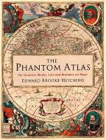
Hardback. The astonishing story of the maps and atlases throughout history that got it completely wrong Num Pages: 256 pages, Full Colour Throughout. BIC Classification: HBG; RGV. Category: (G) General (US: Trade). Dimension: 205 x 257 x 29. Weight in Grams: 860.
- Publisher
- Simon & Schuster Ltd
- Format
- Hardback
- Publication date
- 2016
- Condition
- New
- SKU
- V9781471159459
- ISBN
- 9781471159459
Hardback
Condition: New
€ 33.99€ 21.64
€ 33.99
€ 21.64
Hardcover. Offering an account of the status of maps and geographical knowledge in the Early Modern world, this work focuses on how early European geographers mapped the territories of the Old World (Africa and South-East Asia). Series: Picturing History. Num Pages: 248 pages, 52 b&w illustrations. BIC Classification: HBG; HBLH; HBTP; RGR; RGV. Category: (G) General (US: Trade); (P) Professional & Vocational; (UP) Postgraduate, Research & Scholarly; (UU) Undergraduate. Dimension: 242 x 162 x 21. Weight in Grams: 664.
- Publisher
- Reaktion Books
- Format
- Hardback
- Publication date
- 2004
- Edition
- First UK Edition
- Condition
- New
- SKU
- V9781861890115
- ISBN
- 9781861890115
Hardback
Condition: New
€ 37.37
€ 37.37
Hardcover. People rely on reason to navigate the abstract world of human relations in the same way they rely on maps to traverse the physical world. This work offers a critique of the way human thought and action have become immersed in the rhetoric of cartography and how this cartographic reasoning allows the powerful to map out other people's lives. Num Pages: 584 pages, 45 halftones, 2 maps, 1 line drawing, 24 figures. BIC Classification: JFC; RGV. Category: (P) Professional & Vocational. Dimension: 260 x 189 x 45. Weight in Grams: 1400.
- Publisher
- The University of Chicago Press United States
- Number of pages
- 584
- Format
- Hardback
- Publication date
- 2007
- Edition
- First Edition (1st printing),
- Condition
- New
- SKU
- V9780226629308
- ISBN
- 9780226629308
Hardback
Condition: New
€ 72.46
€ 72.46
Hardcover. Presents an examination of the use of maps for wayfinding. This book considers maps whose makers employed the smallest of scales to envision the broadest of human stages. It looks at maps that are at the opposite end of the scale from cosmological and world maps. It shows ways in which certain maps can be linked to particular events in history. Editor(s): Akerman, James R.; Karrow, Robert W. Num Pages: 336 pages, 198 colour plates. BIC Classification: AGC; HBT; RGS; RGV. Category: (P) Professional & Vocational. Dimension: 284 x 222 x 33. Weight in Grams: 1912.
- Publisher
- The University of Chicago Press United States
- Number of pages
- 336
- Format
- Hardback
- Publication date
- 2007
- Condition
- New
- SKU
- V9780226010755
- ISBN
- 9780226010755
Hardback
Condition: New
€ 132.06
€ 132.06
Paperback. More than a physical space, a hypercity is a real city overlaid with information networks that document the past, catalyze the present, and project future possibilities. Hypercities are always under construction. Hypercities puts digital humanities theory into practice to chart the proliferating cultural records of places around the world. Series: metaLABprojects. Num Pages: 226 pages, illustrations (colour). BIC Classification: JFD; JNV; RGV. Category: (G) General (US: Trade); (P) Professional & Vocational; (UP) Postgraduate, Research & Scholarly. Dimension: 144 x 209 x 17. Weight in Grams: 412.
- Publisher
- Harvard University Press
- Format
- Paperback
- Publication date
- 2014
- Edition
- 2014th Edition
- Condition
- New
- SKU
- V9780674725348
- ISBN
- 9780674725348
Paperback
Condition: New
€ 42.94
€ 42.94
Hardback. Series: The Paul Mellon Centre for Studies in British Art. Num Pages: 240 pages, 50 color + 50 b/w illus. BIC Classification: 1DBKE; 3H; ACK; RGV. Category: (P) Professional & Vocational. Dimension: 230 x 288 x 22. Weight in Grams: 1272.
- Publisher
- Yale University Press
- Format
- Hardback
- Publication date
- 2016
- Condition
- New
- SKU
- V9780300220339
- ISBN
- 9780300220339
Hardback
Condition: New
€ 95.57
€ 95.57
Paperback. This work traces the adventures, discoveries and feats of technical ingenuity by which mapmakers, over the centuries, have succeeded in charting first the surface of the globe, then the earth's interior and the ocean floors, and finally the moon and the planets of our solar system. Num Pages: 528 pages, b&w illustrations. BIC Classification: HBT; RGV. Category: (G) General (US: Trade). Dimension: 233 x 153 x 39. Weight in Grams: 678.
- Publisher
- Pimlico
- Format
- Paperback
- Publication date
- 2002
- Edition
- New Ed
- Condition
- New
- SKU
- V9780712668125
- ISBN
- 9780712668125
Paperback
Condition: New
€ 32.99€ 23.25
€ 32.99
€ 23.25
Paperback. The fascinating story of the creation of the Ordnance Survey map, told for the first time by a brilliant young historian. Num Pages: 432 pages, Illustrations (some col.), maps (some col.). BIC Classification: 1DBK; HBJD1; HBTP1; RGV. Category: (G) General (US: Trade). Dimension: 200 x 130 x 35. Weight in Grams: 366.
- Publisher
- Granta Books
- Format
- Paperback
- Publication date
- 2011
- Edition
- paperback / softback
- Condition
- New
- SKU
- V9781847082541
- ISBN
- 9781847082541
Paperback
Condition: New
€ 17.99€ 12.73
€ 17.99
€ 12.73
Paperback. Num Pages: 293 pages, illustrations. BIC Classification: RGC; RGV; RGW. Category: (G) General (US: Trade); (U) Tertiary Education (US: College). Dimension: 180 x 254 x 18. Weight in Grams: 814.
- Publisher
- Guilford Publications
- Format
- Paperback
- Publication date
- 2016
- Edition
- 3rd Edition
- Condition
- New
- SKU
- V9781462509980
- ISBN
- 9781462509980
Paperback
Condition: New
€ 63.79
€ 63.79
Paperback. 'My name is Mike and I am a map addict. There, it's said..' Mike Parker, presenter of Radio 4's On the Map, celebrates the richness of all things maps in this fantastic, critically-acclaimed read. Num Pages: 336 pages, 1 col plates (8pp). BIC Classification: RGV; WTM. Category: (G) General (US: Trade). Dimension: 196 x 130 x 26. Weight in Grams: 332.
- Publisher
- HarperCollins Publishers
- Number of pages
- 336
- Format
- Paperback
- Publication date
- 2010
- Edition
- Illustrated
- Condition
- New
- SKU
- V9780007351572
- ISBN
- 9780007351572
Paperback
Condition: New
€ 14.99€ 11.16
€ 14.99
€ 11.16


