Cartography, map-making & projections
Results 25 - 48 of 77
Cartography, map-making & projections
Paperback. 'My name is Mike and I am a map addict. There, it's said..' Mike Parker, presenter of Radio 4's On the Map, celebrates the richness of all things maps in this fantastic, critically-acclaimed read. Num Pages: 336 pages, 1 col plates (8pp). BIC Classification: RGV; WTM. Category: (G) General (US: Trade). Dimension: 196 x 130 x 26. Weight in Grams: 332.
- Publisher
- HarperCollins Publishers
- Number of pages
- 336
- Format
- Paperback
- Publication date
- 2010
- Edition
- Illustrated
- Condition
- New
- SKU
- V9780007351572
- ISBN
- 9780007351572
Paperback
Condition: New
€ 14.99€ 11.16
€ 14.99
€ 11.16
Paperback. In this history of the British surveys of India, the author relates how imperial Britain employed modern scientific survey techniques to create and define the spacial image of its Indian empire, and to legitimize its colonialist activities as triumphs of liberal, rational science. Num Pages: 474 pages, 31 halftones, 5 maps, 1 line drawing. BIC Classification: 1FKA; 3JF; 3JH; HBTP; PDX; RGV. Category: (P) Professional & Vocational; (UP) Postgraduate, Research & Scholarly; (UU) Undergraduate. Dimension: 230 x 150 x 27. Weight in Grams: 750.
- Format
- Paperback
- Publication date
- 1999
- Publisher
- The University of Chicago Press United States
- Edition
- New ed
- Number of pages
- 474
- Condition
- New
- SKU
- V9780226184883
- ISBN
- 9780226184883
Paperback
Condition: New
€ 53.33
€ 53.33
Hardcover. * Focuses on an important and newly reinvigorated topic, and one that has growing relevance to many researchers across many social science and humanities disciplines. * The breadth of coverage will uniquely address key topics within the field of mapping. Editor(s): Dodge, Dr. Martin; Perkins, Chris; Kitchen, Rob. Num Pages: 504 pages, Illustrations, maps. BIC Classification: RGV. Category: (P) Professional & Vocational. Dimension: 262 x 204 x 34. Weight in Grams: 1306.
- Format
- Hardback
- Publication date
- 2011
- Publisher
- John Wiley & Sons Inc United Kingdom
- Edition
- 1st Edition
- Number of pages
- 504
- Condition
- New
- SKU
- V9780470742839
- ISBN
- 9780470742839
Hardback
Condition: New
€ 161.09
€ 161.09
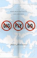
Hardcover. Some maps help us find our way; others restrict where we go and what we do. Restrictive mapping has been indispensable in settling the American West, protecting fragile ocean fisheries, and keeping sex offenders away from playgrounds. This book is suitable for those who vote, own a home, or aspire to be an informed citizen. Num Pages: 216 pages, 63 halftone, 19 line drawings. BIC Classification: JFC; RGV. Category: (G) General (US: Trade). Dimension: 229 x 152 x 20. Weight in Grams: 454.
- Format
- Hardback
- Publication date
- 2010
- Publisher
- The University of Chicago Press United States
- Number of pages
- 216
- Condition
- New
- Edition
- Illustrated
- SKU
- V9780226534671
- ISBN
- 9780226534671
Hardback
Condition: New
€ 120.32
€ 120.32
Hardback. Explains how maps can tell where to anticipate certain hazards, but also how maps can be misleading. The text considers that although it is important to predict and prepare for catastrophic natural hazards, more subtle and persistent phenomena such as pollution and crime also pose serious dangers. Num Pages: 378 pages, 9 line drawings, 107 maps. BIC Classification: 1KBB; JFFC; JKV; RGV; RNP. Category: (P) Professional & Vocational; (UP) Postgraduate, Research & Scholarly; (UU) Undergraduate. Dimension: 235 x 160 x 26. Weight in Grams: 682.
- Format
- Hardback
- Publication date
- 1997
- Publisher
- The University of Chicago Press United States
- Number of pages
- 378
- Condition
- New
- SKU
- V9780226534183
- ISBN
- 9780226534183
Hardback
Condition: New
€ 70.93
€ 70.93
Hardcover. The twentieth century is a pivotal period in map history. Geographic information systems radically altered cartographic institutions and reduced the skill required to create maps. This volume features expert contributors who provide both original research, and interpretations of larger trends in cartography. Editor(s): Monmonier, Mark. Num Pages: 1728 pages, 2 books, 805 colour plates, 119 halftones, 242 line drawings, 61 tables. BIC Classification: 3JJ; HBTP; RGV; TBX. Category: (G) General (US: Trade). Dimension: 309 x 303 x 120. Weight in Grams: 7774.
- Format
- Hardback
- Publication date
- 2015
- Publisher
- University Of Chicago Press
- Condition
- New
- SKU
- V9780226534695
- ISBN
- 9780226534695
Hardback
Condition: New
€ 764.37
€ 764.37
Paperback. Explains how maps can tell where to anticipate certain hazards, but also how maps can be misleading. The text considers that although it is important to predict and prepare for catastrophic natural hazards, more subtle and persistent phenomena such as pollution and crime also pose serious dangers. Num Pages: 378 pages, 2 halftones, 16 line drawings, 97 maps. BIC Classification: 1KBB; JFFC; JKV; RGV; RNP. Category: (P) Professional & Vocational; (UP) Postgraduate, Research & Scholarly; (UU) Undergraduate. Dimension: 231 x 155 x 21. Weight in Grams: 516.
- Format
- Paperback
- Publication date
- 1998
- Publisher
- The University of Chicago Press United States
- Edition
- 1st Edition
- Number of pages
- 378
- Condition
- New
- SKU
- V9780226534190
- ISBN
- 9780226534190
Paperback
Condition: New
€ 53.99
€ 53.99
Paperback. Monmonier shows authors and scholars how they can use expository cartography--the visual, two-dimensional organization of information--to heighten the impact of their books and articles. A concise, practical book that introduces the fundamental principles of graphic logic and design. 112 maps. 1 halftone. Series: Chicago Guides to Writing, Editing and Publishing. Num Pages: 352 pages, 112 maps, 1 halftone. BIC Classification: RGS; RGV. Category: (P) Professional & Vocational; (UP) Postgraduate, Research & Scholarly; (UU) Undergraduate. Dimension: 222 x 142 x 18. Weight in Grams: 458.
- Format
- Paperback
- Publication date
- 1993
- Publisher
- University Of Chicago Press
- Edition
- 1st Edition
- Condition
- New
- SKU
- V9780226534176
- ISBN
- 9780226534176
Paperback
Condition: New
€ 32.05
€ 32.05
Paperback. Some maps help us find our way; others restrict where we go and what we do. These maps control behavior, regulating activities from flying to fishing, prohibiting students from one part of town from being schooled on the other, and banishing certain individuals and industries to the periphery. This title tackles this aspect of mapping. Num Pages: 216 pages, 63 halftones, 19 line drawings. BIC Classification: JFC; RGV. Category: (G) General (US: Trade). Dimension: 227 x 152 x 13. Weight in Grams: 350.
- Format
- Paperback
- Publication date
- 2010
- Publisher
- University Of Chicago Press
- Condition
- New
- SKU
- V9780226534688
- ISBN
- 9780226534688
Paperback
Condition: New
€ 30.75
€ 30.75
With it you'll finally understand the why of wayfinding. Num Pages: 272 pages, 126, 67 black & white halftones, 59 black & white line drawings. BIC Classification: PDZ; RGV; TRLN. Category: (P) Professional & Vocational. Dimension: 236 x 155 x 21. Weight in Grams: 510.
- Publication date
- 2012
- Publisher
- Johns Hopkins University Press United States
- Number of pages
- 272
- Condition
- New
- SKU
- V9781421405117
- ISBN
- 9781421405117
Paperback
Condition: New
€ 76.99
€ 76.99
Hardback. Series: The Paul Mellon Centre for Studies in British Art. Num Pages: 240 pages, 50 color + 50 b/w illus. BIC Classification: 1DBKE; 3H; ACK; RGV. Category: (P) Professional & Vocational. Dimension: 230 x 288 x 22. Weight in Grams: 1272.
- Publisher
- Yale University Press
- Format
- Hardback
- Publication date
- 2016
- Condition
- New
- SKU
- V9780300220339
- ISBN
- 9780300220339
Hardback
Condition: New
€ 95.57
€ 95.57
Hardcover. Spatial Analysis: Modelling in a GIS Environment Edited by Paul Longley and Michael Batty Digital data and information are used increasingly by academics, professionals, local authorities, and government departments. Editor(s): Longley, Paul A.; Batty, Michael. Num Pages: 400 pages, Illustrations (some col.), maps (some col.). BIC Classification: RGV. Category: (P) Professional & Vocational; (UP) Postgraduate, Research & Scholarly; (UU) Undergraduate. Dimension: 238 x 161 x 28. Weight in Grams: 772.
- Format
- Hardback
- Publication date
- 1997
- Publisher
- John Wiley and Sons Ltd United Kingdom
- Edition
- 1st Edition
- Number of pages
- 400
- Condition
- New
- SKU
- V9780470236154
- ISBN
- 9780470236154
Hardback
Condition: New
€ 228.42
€ 228.42
Hardback. A comprehensive atlas of the Great Plains. Num Pages: 352 pages, 8 Illustrations, 312 maps, 11 graphs. BIC Classification: 1KB; GBG; RGL; RGV. Category: (P) Professional & Vocational. Dimension: 7112 x 5487 x 36. Weight in Grams: 2032.
- Format
- Hardback
- Publication date
- 2011
- Publisher
- University of Nebraska Press United States
- Number of pages
- 352
- Condition
- New
- SKU
- V9780803215368
- ISBN
- 9780803215368
Hardback
Condition: New
€ 47.63
€ 47.63
Hardback. The "Vinland Map" first surfaced on the antiquarian market in 1957 and the map's authenticity has been debated ever since in controversies ranging from the anomalous composition of the ink and the map's lack of provenance historical and cartographical riddles. This book addresses the full range of this debate. Num Pages: 480 pages, 18 maps, 14 illustrations. BIC Classification: 1KB; RGS; RGV. Category: (G) General (US: Trade). Dimension: 5817 x 3887 x 32. Weight in Grams: 776.
- Format
- Hardback
- Publication date
- 2004
- Publisher
- Stanford University Press United States
- Number of pages
- 480
- Condition
- New
- SKU
- V9780804749626
- ISBN
- 9780804749626
Hardback
Condition: New
€ 156.04
€ 156.04
Paperback. The "Vinland Map" first surfaced on the antiquarian market in 1957 and the map's authenticity has been debated ever since in controversies ranging from the anomalous composition of the ink and the map's lack of provenance to historical and cartographical riddles. This book addresses the fuli range of this debate. Num Pages: 480 pages, 14 illustrations, 18 maps. BIC Classification: 1KB; RGS; RGV. Category: (G) General (US: Trade). Dimension: 5817 x 3887 x 28. Weight in Grams: 667.
- Format
- Paperback
- Publication date
- 2004
- Publisher
- Stanford University Press United States
- Number of pages
- 480
- Condition
- New
- SKU
- V9780804749633
- ISBN
- 9780804749633
Paperback
Condition: New
€ 46.30
€ 46.30
Paperback. Cartographers have long grappled with the impossibility of portraying the earth in two dimensions. To solve this problem, mapmakers have created map projections. This work discusses and illustrates the known map projections from before 500BC to the present, with facts on their origins and use. Num Pages: 384 pages, 163 maps and charts, 12 portraits. BIC Classification: PDX; RGV. Category: (P) Professional & Vocational; (UP) Postgraduate, Research & Scholarly; (UU) Undergraduate. Dimension: 244 x 171 x 20. Weight in Grams: 668.
- Publisher
- The University of Chicago Press United States
- Number of pages
- 384
- Format
- Paperback
- Publication date
- 1998
- Edition
- New ed
- Condition
- New
- SKU
- V9780226767475
- ISBN
- 9780226767475
Paperback
Condition: New
€ 54.11
€ 54.11
Paperback. This work traces the adventures, discoveries and feats of technical ingenuity by which mapmakers, over the centuries, have succeeded in charting first the surface of the globe, then the earth's interior and the ocean floors, and finally the moon and the planets of our solar system. Num Pages: 528 pages, b&w illustrations. BIC Classification: HBT; RGV. Category: (G) General (US: Trade). Dimension: 233 x 153 x 39. Weight in Grams: 678.
- Publisher
- Pimlico
- Format
- Paperback
- Publication date
- 2002
- Edition
- New Ed
- Condition
- New
- SKU
- V9780712668125
- ISBN
- 9780712668125
Paperback
Condition: New
€ 31.99€ 23.25
€ 31.99
€ 23.25
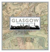
Hardback. .
- Publisher
- Birlinn General
- Format
- Hardback
- Publication date
- 2015
- Edition
- UK ed.
- Condition
- New
- SKU
- V9781780273198
- ISBN
- 9781780273198
Hardback
Condition: New
€ 38.99€ 28.16
€ 38.99
€ 28.16
Paperback. Num Pages: 293 pages, illustrations. BIC Classification: RGC; RGV; RGW. Category: (G) General (US: Trade); (U) Tertiary Education (US: College). Dimension: 180 x 254 x 18. Weight in Grams: 814.
- Publisher
- Guilford Publications
- Format
- Paperback
- Publication date
- 2016
- Edition
- 3rd Edition
- Condition
- New
- SKU
- V9781462509980
- ISBN
- 9781462509980
Paperback
Condition: New
€ 63.79
€ 63.79
Hardback. Why do we put north at the top of maps? Which maps show us the way to Heaven, and which show the "land of no sunshine" or the land of "people with no bowels"? This book looks at the history of maps, from ancient maps such as medieval mappae mundi to Google Earth. Num Pages: 256 pages, maps. BIC Classification: HBTP1; RGV. Category: (G) General (US: Trade). Dimension: 308 x 259 x 23. Weight in Grams: 1614.
- Publisher
- Dorling Kindersley Ltd
- Format
- Hardback
- Publication date
- 2014
- Condition
- New
- SKU
- V9781409345718
- ISBN
- 9781409345718
Hardback
Condition: New
€ 35.99€ 23.83
€ 35.99
€ 23.83
Hardcover. Offering an account of the status of maps and geographical knowledge in the Early Modern world, this work focuses on how early European geographers mapped the territories of the Old World (Africa and South-East Asia). Series: Picturing History. Num Pages: 248 pages, 52 b&w illustrations. BIC Classification: HBG; HBLH; HBTP; RGR; RGV. Category: (G) General (US: Trade); (P) Professional & Vocational; (UP) Postgraduate, Research & Scholarly; (UU) Undergraduate. Dimension: 242 x 162 x 21. Weight in Grams: 664.
- Publisher
- Reaktion Books
- Format
- Hardback
- Publication date
- 2004
- Edition
- First UK Edition
- Condition
- New
- SKU
- V9781861890115
- ISBN
- 9781861890115
Hardback
Condition: New
€ 37.37
€ 37.37
Hardcover. Mapping: A Critical Introduction to Cartography and GIS is an introduction to the critical issues surrounding mapping and Geographic Information Systems (GIS) across a wide range of disciplines for the non-specialist reader. Series: Critical Introductions to Geography. Num Pages: 232 pages, Illustrations, maps. BIC Classification: RGV. Category: (P) Professional & Vocational; (UP) Postgraduate, Research & Scholarly; (UU) Undergraduate. Dimension: 253 x 179 x 18. Weight in Grams: 538.
- Format
- Hardback
- Publication date
- 2010
- Publisher
- John Wiley and Sons Ltd United Kingdom
- Number of pages
- 232
- Condition
- New
- SKU
- V9781405121729
- ISBN
- 9781405121729
Hardback
Condition: New
€ 135.84
€ 135.84
Paperback. Are the power and purpose of maps inherently political? This title addresses this important question and seeks to emphasize that the apparent objectivity' of the map-making and map-using process cannot be divorced from aspects of the politics of representation. Series: Picturing History. Num Pages: 192 pages, 40 black & white illustrations, 20 colour illustrations. BIC Classification: JPA; JPSL; RGV. Category: (P) Professional & Vocational; (UP) Postgraduate, Research & Scholarly; (UU) Undergraduate. Dimension: 235 x 158 x 15. Weight in Grams: 486.
- Format
- Paperback
- Publication date
- 2001
- Publisher
- Reaktion Books United Kingdom
- Number of pages
- 192
- Condition
- New
- SKU
- V9781861890818
- ISBN
- 9781861890818
Paperback
Condition: New
€ 28.92
€ 28.92
Hardcover. BIC Classification: HBW; JWF; RGV; WGG. Category: (G) General (US: Trade). .
- Publisher
- Bloomsbury Publishing PLC
- Format
- Hardback
- Publication date
- 2017
- Condition
- New
- SKU
- V9781472827869
- ISBN
- 9781472827869
Hardback
Condition: New
€ 38.99€ 25.85
€ 38.99
€ 25.85


