74%OFF


Stock image for illustration purposes only - book cover, edition or condition may vary.
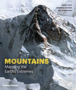
Mountains: Mapping the Earth's Extremes
Stefan Dech
€ 50.99
€ 13.01
FREE Delivery in Ireland
Description for Mountains: Mapping the Earth's Extremes
Hardcover. The German Centre for Aviation and Space Travel created very precise digital pictures of the Alpine mountains with the aid of satellite photographs taken from a height of several hundred kilometres. This title presents these mountain portraits along with personal accounts written by some of the finest climbers in the world. Num Pages: 240 pages, illustrations. BIC Classification: RGBS; RGS; RGV. Category: (G) General (US: Trade). Dimension: 324 x 275 x 26. Weight in Grams: 2142.
Unseen Extremes marks a new milestone in Earth observation and Alpine exploration, presenting thirteen of the world's great mountains in a manner never seen before. The German Centre for Aviation and Space Travel created very precise digital pictures of the mountains with the aid of satellite photographs taken from a height of several hundred kilometres. Scientists used these to produce models of the terrain, which were finally turned into photorealistic, `virtual' views from perspectives and heights that had been hitherto impossible. They capture all the individual features of these giant mountains as an almost tangible reality - the third dimension as a brand new experience. The location of the virtual camera at various places in the topographical map gives a precise picture of the three-dimensional form of each mountain, while infographics and descriptions of the geology, glaciology, geography and climatology detail its individual characteristics. These mountain portraits are completed by personal accounts written by some of the finest climbers in the world and accompanied by a selection of authentic photographs. The accounts from different eras join together with the latest satellite technology, the history of climbing, and the geographical background knowledge to create a unique and comprehensive picture of the mountains and their trail-blazing climbers.
Product Details
Format
Hardback
Publication date
2016
Publisher
Thames and Hudson Ltd
Condition
New
Number of Pages
240
Place of Publication
London, United Kingdom
ISBN
9780500518892
SKU
9780500518892
Shipping Time
Usually ships in 2 to 4 working days
Ref
99-2
About Stefan Dech
Stefan Dech is director of the German Remote Sensing Data Centre at DLR's Earth Observation Centre. Reinhold Messner is a legendary mountaineer. Nils Sparwasser heads the `Science Communication and Visualization' division at the German Remote Sensing Data Centre at DLR's Earth Observation Centre.
Reviews for Mountains: Mapping the Earth's Extremes
Mountains: Mapping the Earth's Extremes...features 13 of the world's most magnificent mountains in an entirely new way. Using high-resolution satellite data, scientists have created a series of 3D maps of mountain landscapes. The breathtaking results provide virtual landscapes from previously impossible viewpoints.
