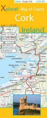

Stock image for illustration purposes only - book cover, edition or condition may vary.
Xploreit Map of County Cork, Ireland
Xploreit Map
€ 15.99
€ 15.85
FREE Delivery in Ireland
Description for Xploreit Map of County Cork, Ireland
With its mixture of rugged mountains, glorious seascapes, rolling hills and wooded valleys, Cork - The 'Rebel' County - provides a multitude of beautiful walking trails, cycle routes and scenic drives. This map can guide you to the numerous leisure spots and renowned destinations such as Blarney Castle, King Charles Fort, and Cape Clear Island. BIC Classification: 1DBR; WTRM. Category: (G) General (US: Trade). Dimension: 254 x 113 x 10. Weight in Grams: 102. Scale 1 : 100 000
With its mixture of rugged mountains, glorious seascapes, gentle rolling hills and wooded valleys, Cork - The 'Rebel' County - provides a multitude of beautiful walking trails, cycle routes and scenic drives. Visitors will find this map indispensable when exploring it on foot, by bike or by car.County Cork is the largest county in Ireland and has a spectacular coastline stretching from the medieval town of Youghal in the south-east all the way to the beautiful Beara peninsula in the south-west. It has a rich heritage of megalithic monuments, medieval churches and castles - many which can be found inland. ... Read more
With its mixture of rugged mountains, glorious seascapes, gentle rolling hills and wooded valleys, Cork - The 'Rebel' County - provides a multitude of beautiful walking trails, cycle routes and scenic drives. Visitors will find this map indispensable when exploring it on foot, by bike or by car.County Cork is the largest county in Ireland and has a spectacular coastline stretching from the medieval town of Youghal in the south-east all the way to the beautiful Beara peninsula in the south-west. It has a rich heritage of megalithic monuments, medieval churches and castles - many which can be found inland. ... Read more
Product Details
Publication date
2008
Publisher
Fountain Software & Publications Ltd Co. Clare
Condition
New
Number of Pages
1
Format
Sheet map, folded
Place of Publication
Ennis, Ireland
ISBN
9780955265525
SKU
9780955265525
Shipping Time
Usually ships in 2 to 4 working days
Ref
99-1
Reviews for Xploreit Map of County Cork, Ireland
