27%OFF

Stock image for illustration purposes only - book cover, edition or condition may vary.
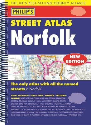
Philip´s Street Atlas Norfolk
Philips
€ 19.99
€ 14.50
FREE Delivery in Ireland
Description for Philip´s Street Atlas Norfolk
Spiral bound. A fully updated edition of this spiral-bound Philip's street atlas of Norfolk, giving detailed coverage of the region. The atlas is suitable for both business and leisure use. BIC Classification: 1DBKEAN; WTRS. Category: (G) General (US: Trade). Dimension: 272 x 197 x 18. Weight in Grams: 430.
THE ONLY COUNTY STREET ATLAS WITH ALL THE NAMED STREETS OF NORFOLK The UK's best-selling county street atlases More than 24,000 named streets, roads, lanes and alleys The essential map book for residents and visitors - and if you're moving to Norfolk Includes all the streets in BECCLES, GREAT YARMOUTH, KING'S LYNN, Norwich, Thetford, Attleborough, Aylsham, Brundall, Bungay, Caister-on-Sea, Cromer, Dersingham, Diss, Downham Market, Fakenham, Harleston, Heacham, Hemsby, Hunstanton, Lakenheath, Loddon, North Walsham, Sheringham, Swaffham, Watton, Wells-next-the-Sea, Wisbech, Wymondham - New edition in practical spiral-bound format - Street ... Read more
THE ONLY COUNTY STREET ATLAS WITH ALL THE NAMED STREETS OF NORFOLK The UK's best-selling county street atlases More than 24,000 named streets, roads, lanes and alleys The essential map book for residents and visitors - and if you're moving to Norfolk Includes all the streets in BECCLES, GREAT YARMOUTH, KING'S LYNN, Norwich, Thetford, Attleborough, Aylsham, Brundall, Bungay, Caister-on-Sea, Cromer, Dersingham, Diss, Downham Market, Fakenham, Harleston, Heacham, Hemsby, Hunstanton, Lakenheath, Loddon, North Walsham, Sheringham, Swaffham, Watton, Wells-next-the-Sea, Wisbech, Wymondham - New edition in practical spiral-bound format - Street ... Read more
Product Details
Publisher
Octopus Publishing Group
Format
Paperback
Publication date
2016
Condition
New
Number of Pages
224
Place of Publication
London, United Kingdom
ISBN
9781849074285
SKU
V9781849074285
Shipping Time
Usually ships in 5 to 9 working days
Ref
99-99
Reviews for Philip´s Street Atlas Norfolk
