Cartography, map-making & projections
Results 21 - 40 of 76
Cartography, map-making & projections
Hardcover. Geographic Visualization: Concepts, Tools and Applications is a 'state-of-the-art' review of the latest developments in the subject. It examines how new concepts, methods and tools can be creatively applied to solve problems relevant to a wide range of topics. Editor(s): Dodge, Dr. Martin; Turner, Martin; McDerby, Mary. Num Pages: 348 pages, Illustrations (some col.), maps. BIC Classification: RGV. Category: (P) Professional & Vocational. Dimension: 179 x 254 x 25. Weight in Grams: 990.
- Format
- Hardback
- Publication date
- 2008
- Publisher
- John Wiley & Sons Inc United Kingdom
- Edition
- 1st Edition
- Number of pages
- 348
- Condition
- New
- SKU
- V9780470515112
- ISBN
- 9780470515112
Hardback
Condition: New
€ 116.72
€ 116.72
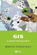
Paperback. This guide enables students of human geography to take a critical look at the set of practices, hardware and software that are together described as GIS. * A guide to GIS for students of human geography. * Outlines the distinct approaches to inquiry employed in GIS and illustrates their relevance for human geographers. Series: Short Introductions to Geography. Num Pages: 184 pages, 54. BIC Classification: RGV; RNT. Category: (P) Professional & Vocational. Dimension: 229 x 155 x 14. Weight in Grams: 282.
- Format
- Paperback
- Publication date
- 2004
- Publisher
- John Wiley and Sons Ltd United Kingdom
- Edition
- 1st Edition
- Number of pages
- 184
- Condition
- New
- SKU
- V9780631235330
- ISBN
- 9780631235330
Paperback
Condition: New
€ 41.99€ 40.57
€ 41.99
€ 40.57
Paperback. Editor(s): Grinderud, Knut; Rasmussen, Haakon; Nilsen, Steinar; Lillethun, Arvid; Holten, Atle; Sanderud, Oystein. Num Pages: 212 pages, colour photos, maps & illus. BIC Classification: RGV. Category: (P) Professional & Vocational; (UP) Postgraduate, Research & Scholarly; (UU) Undergraduate. Dimension: 269 x 246 x 12. Weight in Grams: 866.
- Format
- Paperback
- Publication date
- 2009
- Publisher
- Tapir Academic Press Norway
- Number of pages
- 212
- Condition
- New
- SKU
- V9788251924269
- ISBN
- 9788251924269
Paperback
Condition: New
€ 57.54€ 44.58
€ 57.54
€ 44.58
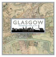
Hardback. .
- Publisher
- Birlinn General
- Format
- Hardback
- Publication date
- 2015
- Edition
- UK ed.
- Condition
- New
- SKU
- V9781780273198
- ISBN
- 9781780273198
Hardback
Condition: New
€ 38.99€ 32.73
€ 38.99
€ 32.73
Hardback. Why do we put north at the top of maps? Which maps show us the way to Heaven, and which show the "land of no sunshine" or the land of "people with no bowels"? This book looks at the history of maps, from ancient maps such as medieval mappae mundi to Google Earth. Num Pages: 256 pages, maps. BIC Classification: HBTP1; RGV. Category: (G) General (US: Trade). Dimension: 308 x 259 x 23. Weight in Grams: 1614.
- Publisher
- Dorling Kindersley Ltd
- Format
- Hardback
- Publication date
- 2014
- Condition
- New
- SKU
- V9781409345718
- ISBN
- 9781409345718
Hardback
Condition: New
€ 32.99€ 22.03
€ 32.99
€ 22.03
Paperback. More than a physical space, a hypercity is a real city overlaid with information networks that document the past, catalyze the present, and project future possibilities. Hypercities are always under construction. Hypercities puts digital humanities theory into practice to chart the proliferating cultural records of places around the world. Series: metaLABprojects. Num Pages: 226 pages, illustrations (colour). BIC Classification: JFD; JNV; RGV. Category: (G) General (US: Trade); (P) Professional & Vocational; (UP) Postgraduate, Research & Scholarly. Dimension: 144 x 209 x 17. Weight in Grams: 412.
- Publisher
- Harvard University Press
- Format
- Paperback
- Publication date
- 2014
- Edition
- 2014th Edition
- Condition
- New
- SKU
- V9780674725348
- ISBN
- 9780674725348
Paperback
Condition: New
€ 33.99€ 29.10
€ 33.99
€ 29.10
Hardcover. If one had looked for a potential global city in Europe in the 1540s, the most likely candidate would have been Antwerp. Using his discovery of a network of Chinese merchant shipping routes on John Selden's map of China, the author reveals how London also flourished because of its encounters, engagements, and exchanges with East Asian cities. Num Pages: 320 pages, 43 halftones. BIC Classification: 1DBKESL; 3JB; 3JD; RGC; RGV. Category: (UP) Postgraduate, Research & Scholarly. Dimension: 236 x 164 x 24. Weight in Grams: 600.
- Format
- Hardback
- Publication date
- 2014
- Publisher
- The University of Chicago Press United States
- Edition
- y
- Number of pages
- 320
- Condition
- New
- SKU
- V9780226080659
- ISBN
- 9780226080659
Hardback
Condition: New
€ 53.99€ 41.24
€ 53.99
€ 41.24
Paperback. Num Pages: 293 pages, illustrations. BIC Classification: RGC; RGV; RGW. Category: (G) General (US: Trade); (U) Tertiary Education (US: College). Dimension: 180 x 254 x 18. Weight in Grams: 814.
- Publisher
- Guilford Publications
- Format
- Paperback
- Publication date
- 2016
- Edition
- 3rd Edition
- Condition
- New
- SKU
- V9781462509980
- ISBN
- 9781462509980
Paperback
Condition: New
€ 63.67
€ 63.67
Paperback. 'My name is Mike and I am a map addict. There, it's said..' Mike Parker, presenter of Radio 4's On the Map, celebrates the richness of all things maps in this fantastic, critically-acclaimed read. Num Pages: 336 pages, 1 col plates (8pp). BIC Classification: RGV; WTM. Category: (G) General (US: Trade). Dimension: 196 x 130 x 26. Weight in Grams: 332.
- Publisher
- HarperCollins Publishers
- Number of pages
- 336
- Format
- Paperback
- Publication date
- 2010
- Edition
- Illustrated
- Condition
- New
- SKU
- V9780007351572
- ISBN
- 9780007351572
Paperback
Condition: New
€ 14.99€ 11.02
€ 14.99
€ 11.02
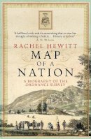
Paperback. The fascinating story of the creation of the Ordnance Survey map, told for the first time by a brilliant young historian. Num Pages: 432 pages, Illustrations (some col.), maps (some col.). BIC Classification: 1DBK; HBJD1; HBTP1; RGV. Category: (G) General (US: Trade). Dimension: 200 x 130 x 35. Weight in Grams: 366.
- Publisher
- Granta Books
- Format
- Paperback
- Publication date
- 2011
- Edition
- paperback / softback
- Condition
- New
- SKU
- V9781847082541
- ISBN
- 9781847082541
Paperback
Condition: New
€ 16.99€ 12.58
€ 16.99
€ 12.58
Paperback. Follows the career of Dominion Land Surveyor Morrison Parsons Bridgland, who provided the first detailed maps of many regions of the Canadian Rockies. This title tells the story of Rocky Mountain Repeat Photography Project, which studies the changes sustained in the Rockies, repeating the field work accomplished by Bridgland almost a century ago. Series: Mountain Cairns: A Series on the History and Culture of the Canadian Rocky Mountains. Num Pages: 312 pages, b/w illus & colour maps. BIC Classification: 1KBC; RGB; RGV. Category: (P) Professional & Vocational. Dimension: 254 x 190 x 20. Weight in Grams: 684.
- Format
- Paperback
- Publication date
- 2005
- Publisher
- University of Alberta Press Canada
- Edition
- 1st
- Number of pages
- 312
- Condition
- New
- SKU
- V9780888644565
- ISBN
- 9780888644565
Paperback
Condition: New
€ 38.99€ 31.31
€ 38.99
€ 31.31
Paperback. In this history of the British surveys of India, the author relates how imperial Britain employed modern scientific survey techniques to create and define the spacial image of its Indian empire, and to legitimize its colonialist activities as triumphs of liberal, rational science. Num Pages: 474 pages, 31 halftones, 5 maps, 1 line drawing. BIC Classification: 1FKA; 3JF; 3JH; HBTP; PDX; RGV. Category: (P) Professional & Vocational; (UP) Postgraduate, Research & Scholarly; (UU) Undergraduate. Dimension: 230 x 150 x 27. Weight in Grams: 750.
- Format
- Paperback
- Publication date
- 1999
- Publisher
- The University of Chicago Press United States
- Edition
- New ed
- Number of pages
- 474
- Condition
- New
- SKU
- V9780226184883
- ISBN
- 9780226184883
Paperback
Condition: New
€ 42.99€ 33.12
€ 42.99
€ 33.12
Paperback. An informative--and beautiful--exploration of the life and history of a city through its maps. Editor(s): Krieger, Alex; Cobb, David. Num Pages: 292 pages, 100 colour and 137 b&w illustrations, maps. BIC Classification: 1KBBES; HBJK; RGS; RGV. Category: (P) Professional & Vocational; (UP) Postgraduate, Research & Scholarly; (UU) Undergraduate. Dimension: 292 x 305 x 19. Weight in Grams: 1684.
- Format
- Paperback
- Publication date
- 2001
- Publisher
- MIT Press Ltd United States
- Number of pages
- 292
- Condition
- New
- SKU
- V9780262611732
- ISBN
- 9780262611732
Paperback
Condition: New
€ 33.73
€ 33.73
Hardcover. Mapping England shows, through a series of compelling maps, both historic and contemporary, how England has scrutinised itself, been seen by others and how it has recorded its ever-changing circumstances. Editor(s): Craig, Blanche. Num Pages: 288 pages, 250 b/w and colour illustrations. BIC Classification: 1DBKE; HBTP1; RGS; RGV. Category: (G) General (US: Trade). Dimension: 298 x 249 x 29. Weight in Grams: 1922. 288 pages, 250 b/w and colour illustrations. Editor(s): Craig, Blanche. Cateogry: (G) General (US: Trade). BIC Classification: 1DBKE; HBTP1; RGS; RGV. Dimension: 298 x 249 x 29. Weight: 1922.
- Format
- Hardback
- Publication date
- 2008
- Publisher
- Black Dog Publishing
- Number of pages
- 288
- Condition
- New
- SKU
- V9781906155513
- ISBN
- 9781906155513
Hardback
Condition: New
€ 69.66
€ 69.66
Paperback. Num Pages: 821 pages, black & white illustrations, maps, figures. BIC Classification: RGV; UTC. Category: (G) General (US: Trade); (U) Tertiary Education (US: College). Dimension: 254 x 180 x 19. Weight in Grams: 746.
- Publisher
- Guilford Publications
- Format
- Paperback
- Publication date
- 2014
- Edition
- 1st Edition
- Condition
- New
- SKU
- V9781462510412
- ISBN
- 9781462510412
Paperback
Condition: New
€ 82.39
€ 82.39
Hardback. Num Pages: 821 pages, black & white illustrations, black & white tables, figures. BIC Classification: RGV; UTC. Category: (G) General (US: Trade); (U) Tertiary Education (US: College). Dimension: 254 x 178 x 25. Weight in Grams: 938.
- Format
- Hardback
- Publication date
- 2014
- Publisher
- Guilford Publications United States
- Number of pages
- 821
- Condition
- New
- Edition
- 1st Edition
- SKU
- V9781462514038
- ISBN
- 9781462514038
Hardback
Condition: New
€ 121.20
€ 121.20
Paperback. Monmonier shows authors and scholars how they can use expository cartography--the visual, two-dimensional organization of information--to heighten the impact of their books and articles. A concise, practical book that introduces the fundamental principles of graphic logic and design. 112 maps. 1 halftone. Series: Chicago Guides to Writing, Editing and Publishing. Num Pages: 352 pages, 112 maps, 1 halftone. BIC Classification: RGS; RGV. Category: (P) Professional & Vocational; (UP) Postgraduate, Research & Scholarly; (UU) Undergraduate. Dimension: 222 x 142 x 18. Weight in Grams: 458.
- Format
- Paperback
- Publication date
- 1993
- Publisher
- University Of Chicago Press
- Edition
- 1st Edition
- Condition
- New
- SKU
- V9780226534176
- ISBN
- 9780226534176
Paperback
Condition: New
€ 18.99€ 16.33
€ 18.99
€ 16.33
Hardcover. BIC Classification: HBW; JWF; RGV; WGG. Category: (G) General (US: Trade). .
- Publisher
- Bloomsbury Publishing PLC
- Format
- Hardback
- Publication date
- 2017
- Condition
- New
- SKU
- V9781472827869
- ISBN
- 9781472827869
Hardback
Condition: New
€ 33.99€ 26.12
€ 33.99
€ 26.12
Hardcover. Mapping the Holy Land provides a unique study of the cartography of the Holy Land during the formative period of its development. Series: Historical Geography. Num Pages: 256 pages, 24 black and white maps, 10 colour maps. BIC Classification: 1FBP; HBJF1; RGV. Category: (UP) Postgraduate, Research & Scholarly. Dimension: 256 x 189 x 25. .
- Publisher
- Bloomsbury Publishing PLC
- Format
- Hardback
- Publication date
- 2017
- Condition
- New
- SKU
- V9781784534547
- ISBN
- 9781784534547
Hardback
Condition: New
€ 125.13
€ 125.13
Hardback. * This is an original and engaging account of the ways in which the discovery of the new world altered the world-view of Europeans during the Renaissance* The author is one of the best young historians in France today. . Num Pages: 216 pages, 0. BIC Classification: 1KLSB; 3JB; BG; RGR; RGV. Category: (P) Professional & Vocational; (UP) Postgraduate, Research & Scholarly; (UU) Undergraduate. Dimension: 239 x 164 x 20. Weight in Grams: 506.
- Format
- Hardback
- Publication date
- 1994
- Publisher
- John Wiley and Sons Ltd United Kingdom
- Number of pages
- 216
- Condition
- New
- SKU
- V9780745611471
- ISBN
- 9780745611471
Hardback
Condition: New
€ 69.74
€ 69.74


