Travel maps & atlases
Results 121 - 144 of 1380
Travel maps & atlases
Paperback. .
- Publisher
- Heron Maps
- Format
- Paperback
- Publication date
- 2017
- Edition
- 3rd Revised edition
- Condition
- New
- SKU
- V9781908851239
- ISBN
- 9781908851239
Paperback
Condition: New
€ 11.61
€ 11.61
Sheet map, folded. Series: Waterways Series. Num Pages: 2 pages. BIC Classification: WTR; WTRM. Category: (G) General (US: Trade). Dimension: 218 x 162 x 1. Weight in Grams: 52.
- Publisher
- Heron Maps
- Publication date
- 2014
- Condition
- New
- SKU
- V9781908851093
- ISBN
- 9781908851093
Paperback
Condition: New
€ 9.50
€ 9.50
Sheet map. Series: Insight Flexi Maps. BIC Classification: 1DDN; WTRS. Category: (G) General (US: Trade). .
- Publisher
- APA Publications
- Publication date
- 2017
- Edition
- 5th Edition
- Condition
- New
- SKU
- V9781786719164
- ISBN
- 9781786719164
Paperback
Condition: New
€ 8.07
€ 8.07
Sheet map. Series: Insight Flexi Maps. BIC Classification: 1FPC; WTRM. Category: (G) General (US: Trade). Dimension: 220 x 100. .
- Publisher
- APA Publications
- Publication date
- 2017
- Edition
- 6th Revised edition
- Condition
- New
- SKU
- V9781786719133
- ISBN
- 9781786719133
Paperback
Condition: New
€ 9.24
€ 9.24
Sheet map. Series: Insight Travel Maps. BIC Classification: 1DSE; WTRM. Category: (G) General (US: Trade). .
- Publisher
- Insight Guides Travel Map Andalucia & Costa del Sol
- Publication date
- 2017
- Edition
- 3rd Revised edition
- Condition
- New
- SKU
- V9781786719003
- ISBN
- 9781786719003
Paperback
Condition: New
€ 6.16
€ 6.16
Sheet map. Includes a list - with descriptions and some photographs - of 29 recommended sights of Kuala Lumpur, divided by theme and linked to the mapping by numbered markers. This book presents information section with details on getting around, tourist offices, tipping, opening times, telecommunications, emergency telephone numbers and climate. Series: Insight Flexi Maps. Num Pages: 2 pages. BIC Classification: 1FMM; WTRM. Category: (G) General (US: Trade). Dimension: 224 x 100 x 9. Weight in Grams: 48.
- Publisher
- APA Publications
- Publication date
- 2015
- Edition
- 5th Revised edition
- Condition
- New
- SKU
- V9781780053974
- ISBN
- 9781780053974
Paperback
Condition: New
€ 9.24
€ 9.24
Sheet map. Series: Insight Flexi Maps. BIC Classification: 1DST; WTRD. Category: (G) General (US: Trade). Dimension: 221 x 198. .
- Publisher
- APA Publications
- Publication date
- 2017
- Edition
- 5th Edition
- Condition
- New
- SKU
- V9781786718846
- ISBN
- 9781786718846
Paperback
Condition: New
€ 8.03
€ 8.03
Sheet map. Series: Insight Flexi Maps. Num Pages: 1 pages. BIC Classification: 1HFMS; WTRS. Category: (G) General (US: Trade). Dimension: 170 x 217 x 9. Weight in Grams: 56.
- Edition
- 3rd Edition
- Publisher
- APA Publications
- Publication date
- 2012
- Condition
- New
- SKU
- KRD0000083
- ISBN
- 9781780054162
Paperback
Condition: New
€ 4.99
€ 4.99
Paperback. Num Pages: 276 pages, photos & map. BIC Classification: 1FBH; HRCR; WTR. Category: (G) General (US: Trade). Dimension: 227 x 110 x 15. Weight in Grams: 276.
- Format
- Paperback
- Publication date
- 2000
- Publisher
- BIBAL Press United States
- Number of pages
- 276
- Condition
- New
- SKU
- V9780941037938
- ISBN
- 9780941037938
Paperback
Condition: New
€ 23.99€ 18.06
€ 23.99
€ 18.06
Hardcover. Provides an illustrated account of the role that charts have played in planning, preventing, conducting and recording war on water. An introduction discusses the major themes with regard to naval warfare, navigation, and chart-making. The first chapter covers the period from earliest recorded history to the fifteenth century. Num Pages: 160 pages, 150 illustrations. BIC Classification: HBTM; JWF; TRLN; WTRM. Category: (G) General (US: Trade). Dimension: 313 x 290 x 17. Weight in Grams: 1306.
- Format
- Hardback
- Publication date
- 2006
- Publisher
- Conway
- Condition
- New
- SKU
- 9781844860319
- ISBN
- 9781844860319
Hardback
Condition: New
€ 23.99€ 8.87
€ 23.99
€ 8.87
Sheet map, folded. Series: Old O.S. Maps of Staffordshire. BIC Classification: 1DBKEMS; 3JJC; WQH; WTRM. Category: (G) General (US: Trade). Dimension: 209 x 122 x 3. Weight in Grams: 24. Staffordshire Sheet 62.06. Series: Old O.S. Maps of Staffordshire. Cateogry: (G) General (US: Trade). BIC Classification: 1DBKEMS; 3JJC; WQH; WTR. Dimension: 209 x 122 x 3. Weight: 24.
- Publisher
- The Godfrey Edition
- Publication date
- 1994
- Edition
- Facsim.of 1901 Ed
- Condition
- New
- SKU
- V9780850547047
- ISBN
- 9780850547047
Hardback
Condition: New
€ 6.87
€ 6.87
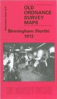
Sheet map, folded. Series: Old Ordnance Survey Maps of Warwickshire. BIC Classification: 1DBKEMW; 3JJC; WQH; WTRM. Category: (G) General (US: Trade). Dimension: 122 x 208 x 7. Weight in Grams: 24. Warwickshire Sheet 14.01. Series: Old Ordnance Survey Maps of Warwickshire. Cateogry: (G) General (US: Trade). BIC Classification: 1DBKEMW; 3JJC; WQH; WTR. Dimension: 134 x 201 x 1. Weight: 26.
- Publisher
- Alan Godfrey Maps
- Publication date
- 1997
- Edition
- Facsim.of 1913 Ed
- Condition
- New
- SKU
- V9780850549058
- ISBN
- 9780850549058
Hardback
Condition: New
€ 6.87
€ 6.87
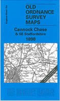
Sheet map, folded. Series: Old Ordnance Survey Maps of England & Wales. BIC Classification: 1DBKEMS; WQH; WTRM. Category: (G) General (US: Trade). Dimension: 199 x 121 x 3. Weight in Grams: 24.
- Publisher
- Alan Godfrey Maps United Kingdom
- Publication date
- 2001
- Edition
- Facsim.of 1898 Ed
- Condition
- New
- SKU
- V9781841512419
- ISBN
- 9781841512419
Hardback
Condition: New
€ 6.85
€ 6.85
Paperback. 28 circular, graded walks all tried and tested by seasoned walkers. The routes range from extended strolls to exhilarating hikes, so there is something for everyone. Series: Pathfinder Guide. Num Pages: 95 pages. BIC Classification: 1DBKEWD; WSZC; WTRM. Category: (G) General (US: Trade). Dimension: 135 x 227 x 7. Weight in Grams: 210.
- Publisher
- Ordnance Survey/Crimson
- Format
- Paperback
- Publication date
- 2016
- Edition
- Revised edition
- Condition
- New
- SKU
- V9780319090305
- ISBN
- 9780319090305
Paperback
Condition: New
€ 16.99€ 13.77
€ 16.99
€ 13.77
Hardcover. Traced through a wide-ranging series of texts, and through a tapestry of images, this book includes photographs, archival material, satellite images and artworks. Num Pages: 464 pages, col. Illustrations, col. maps, ports. (some col.). BIC Classification: 1DBR; WTRS. Category: (G) General (US: Trade). Dimension: 299 x 237 x 39. Weight in Grams: 2572.
- Edition
- Illustrated
- Publisher
- Cork University Press
- Number of pages
- 464
- Format
- Hardback
- Publication date
- 2005
- Condition
- New
- SKU
- V9781859183809
- ISBN
- 9781859183809
Hardback
Condition: New
€ 59.00€ 45.48
€ 59.00
€ 45.48
Sheet map, folded. Series: Old Ordnance Survey Maps - Inch to the Mile. BIC Classification: 1DBKEYK; WQH; WTRM. Category: (G) General (US: Trade). Dimension: 210 x 121 x 3. Weight in Grams: 26.
- Publisher
- Alan Godfrey Maps United Kingdom
- Publication date
- 2000
- Edition
- Facsim.of 1907 Ed
- Condition
- New
- SKU
- V9781841511832
- ISBN
- 9781841511832
Hardback
Condition: New
€ 6.85
€ 6.85
Sheet map, folded. Series: Old O.S. Maps of England and Wales. BIC Classification: 1DBKEMD; WQH; WTRM. Category: (G) General (US: Trade). Dimension: 211 x 123 x 3. Weight in Grams: 24. One Inch Sheet 125. Series: Old O.S. Maps of England and Wales. Cateogry: (G) General (US: Trade). BIC Classification: 1DBKEMD; WQH; WTRM. Dimension: 211 x 123 x 3. Weight: 26.
- Publisher
- Alan Godfrey Maps
- Publication date
- 2002
- Edition
- Facsimile
- Condition
- New
- SKU
- V9781841514420
- ISBN
- 9781841514420
Hardback
Condition: New
€ 6.87
€ 6.87
Sheet map, folded. .
- Publisher
- Alan Godfrey Maps
- Publication date
- 2005
- Condition
- New
- SKU
- V9781841517933
- ISBN
- 9781841517933
Hardback
Condition: New
€ 6.87
€ 6.87
Paperback. Vikings were more than just marine warriors. This atlas shows their development as traders and craftsmen, explorers, settlers and mercenaries. It contains over sixty colour maps, and follows the tracks of the Viking merchants who travelled deep into Russia, and of Viking mercenaries who served in the emperor's bodyguard at Constantinople. Num Pages: 144 pages, colour illustrations, maps, diagrams, further reading, index. BIC Classification: 1DN; HBJD; HBLC; WTRM. Category: (G) General (US: Trade). Dimension: 246 x 179 x 9. Weight in Grams: 394.
- Edition
- 01st Edition
- Publisher
- Penguin
- Format
- Paperback
- Publication date
- 1995
- Condition
- New
- SKU
- V9780140513288
- ISBN
- 9780140513288
Paperback
Condition: New
€ 24.99€ 17.55
€ 24.99
€ 17.55
Paperback. First published in 1953, the year that saw thousands descend on London to watch the coronation of Queen Elizabeth II, this is a lexicon of the city's curiosities, from the Achilles statue in Hyde Park 'erected by the women of England to honour (if not to resemble) the Duke of Wellington', to zebra crossings (relative newcomers to London in 1953). Num Pages: 152 pages, illustrations. BIC Classification: 1DBKESL; WTRS. Category: (G) General (US: Trade). Dimension: 111 x 179 x 19. Weight in Grams: 124.
- Format
- Paperback
- Publication date
- 2016
- Publisher
- Thames & Hudson Ltd
- Condition
- New
- SKU
- 9780500292471
- ISBN
- 9780500292471
Paperback
Condition: New
€ 8.99€ 5.70
€ 8.99
€ 5.70
Flexibound. An atlas that takes us across the oceans of the world to fifty remote islands. It features rare animals and lost explorers, marooned slaves and lonely scientists, mutinous sailors and forgotten castaways. Num Pages: 240 pages, 50 maps and other illustrations. BIC Classification: WTL; WTRM. Category: (G) General (US: Trade). Dimension: 171 x 112 x 20. Weight in Grams: 286.
- Publisher
- Particular Books
- Number of pages
- 240
- Publication date
- 2012
- Edition
- 01st Edition
- Condition
- New
- SKU
- V9781846143496
- ISBN
- 9781846143496
Paperback
Condition: New
€ 27.99€ 19.83
€ 27.99
€ 19.83
Hardback. Despite the dedicated efforts of many individuals and organizations, the great apes are on the very edge of extinction. This atlas provides an overview of what is known about the six species of great apes - chimpanzee, bonobo, Sumatran orangutan, Bornean orangutan, eastern gorilla, and western lowland gorilla. Num Pages: 456 pages, 150 color illustrations, 50 maps. BIC Classification: RNCB; RNKH; WTRM. Category: (G) General (US: Trade). Dimension: 286 x 224 x 26. Weight in Grams: 2106.
- Format
- Hardback
- Publication date
- 2005
- Publisher
- University of California Press United States
- Edition
- 1st Edition
- Number of pages
- 456
- Condition
- New
- SKU
- V9780520246331
- ISBN
- 9780520246331
Hardback
Condition: New
€ 62.29€ 52.61
€ 62.29
€ 52.61
Sheet map, folded. Series: Old O.S. Maps of Cheshire. BIC Classification: 1DBKENC; WQH; WTRM. Category: (G) General (US: Trade). Dimension: 160 x 122 x 2. Weight in Grams: 24.
- Publisher
- Alan Godfrey Maps United Kingdom
- Publication date
- 2004
- Condition
- New
- SKU
- V9781841516394
- ISBN
- 9781841516394
Hardback
Condition: New
€ 6.88
€ 6.88
Sheet map, folded. Series: Old O.S. Maps of Lancashire. BIC Classification: 1DBKENL; 3JJC; WQH; WTRM. Category: (G) General (US: Trade). Dimension: 208 x 121 x 3. Weight in Grams: 26. Lancashire Sheet 113.12. Series: Old O.S. Maps of Lancashire. Cateogry: (G) General (US: Trade). BIC Classification: 1DBKENL; 3JJC; WQH; WTRM. Dimension: 208 x 121 x 3. Weight: 26.
- Publisher
- Alan Godfrey Maps
- Publication date
- 2000
- Edition
- Facsimile of 1905 ed
- Condition
- New
- SKU
- V9781841511894
- ISBN
- 9781841511894
Hardback
Condition: New
€ 6.85
€ 6.85


