7%OFF

Stock image for illustration purposes only - book cover, edition or condition may vary.
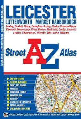
A-Z Leicester (Street Atlas)
A-Z Maps
€ 7.99
€ 7.44
FREE Delivery in Ireland
Description for A-Z Leicester (Street Atlas)
Paperback. Num Pages: 104 pages. BIC Classification: 1DBKEML; WTRS. Category: (G) General (US: Trade). Dimension: 217 x 150 x 6. Weight in Grams: 172.
This A-Z map of Leicester is a full colour paperback featuring 62 pages of street mapping covering:
•Anstey
•Birstall
•Blaby
•Broughton Astley
•Cosby
•Countesthorpe
•Kibworth Beauchamp
•Kirby Muxloe
•Leicester Airport
•Markfield
•Oadby
•Sapcote
•Syston
•Thurmaston
•Thurnby
•Whetstone
•Wigston
There is separate coverage of Lutterworth and Market Harborough and a large scale city centre map of Leicester.
Postcode districts, one-way streets and safety camera locations with maximum speeds are featured on the mapping.
... Read moreProduct Details
Publisher
Geographers a-Z
Format
Paperback
Publication date
2015
Condition
New
Number of Pages
104
Place of Publication
, United Kingdom
ISBN
9781782570844
SKU
V9781782570844
Shipping Time
Usually ships in 5 to 9 working days
Ref
99-99
About A-Z Maps
Britain’s leading street map publisher providing cartographic services, digital data products and paper mapping publications (including Street Atlases, Visitors Guides, Great Britain Road Atlases and The Adventure Atlas).
Reviews for A-Z Leicester (Street Atlas)
