Active outdoor pursuits
Results 1521 - 1540 of 2318
Active outdoor pursuits
Paperback. The Nuttalls are hills over 2000ft high in England and Wales. The 190 Nuttalls in Wales are split into: Carneddau, Glyders, Snowdon, Moel Hebog, Moelwyns, Arenigs, Berwyns, Arans, Rhinogs, Cadair Idris, central Wales, Black Mountains, Brecon Beacons. Definitive lists, detailed route descriptions, maps and drawings of Wales' highest peaks. Num Pages: 250 pages, 70 b&w line drawings and 68 sketch maps. BIC Classification: 1DBKE; 1DBKW; WSZC; WTH. Category: (G) General (US: Trade). Dimension: 179 x 125 x 18. Weight in Grams: 318. 250 pages, 70 b&w line drawings and 68 sketch maps. The Nuttalls are hills over 2000ft high in England and Wales. The 190 Nuttalls in Wales are split into: Carneddau, Glyders, Snowdon, Moel Hebog, Moelwyns, Arenigs, Berwyns, Arans, Rhinogs, Cadair Idris, central Wales, Black Mountains, Brecon Beacons. Definitive lists, detailed route descriptions, maps and drawings of Wales' highest peaks. Cateogry: (G) General (US: Trade). BIC Classification: 1DBKE; 1DBKW; WSZC; WTH. Dimension: 179 x 125 x 18. Weight: 336.
- Publisher
- Cicerone Press
- Number of pages
- 250
- Format
- Paperback
- Publication date
- 2009
- Edition
- 3rd Revised edition
- Condition
- New
- SKU
- V9781852845940
- ISBN
- 9781852845940
Paperback
Condition: New
€ 21.99€ 17.01
€ 21.99
€ 17.01
Paperback. .
- Publisher
- Challenge Publications
- Number of pages
- 68
- Format
- Paperback
- Publication date
- 2013
- Edition
- 4th edition
- Condition
- New
- SKU
- V9781903568705
- ISBN
- 9781903568705
Paperback
Condition: New
€ 8.72
€ 8.72
Sheet map, folded. Series: OS Landranger Map. BIC Classification: 1DBKSH; WSZC; WTRM. Category: (G) General (US: Trade). Dimension: 136 x 228 x 43. Weight in Grams: 98.
- Publisher
- Ordnance Survey
- Publication date
- 2016
- Edition
- February 2016 ed
- Condition
- New
- SKU
- V9780319261323
- ISBN
- 9780319261323
Paperback
Condition: New
€ 16.99€ 13.77
€ 16.99
€ 13.77
Paperback. 40 Town and Country Walks. Series: Pocket Mountains S. 96 pages, full colour illustrations throughout. The tranquil borderland of the Marches, offers a varied landscape truncated by rivers meandering to lowland plains. This title explores all the best places to visit in this area of the country. Cateogry: (G) General (US: Trade). BIC Classification: 1DBKW; WSZC; WTH. Dimension: 102 x 146 x 8. Weight: 124.
- Publisher
- Pocket Mountains
- Number of pages
- 96
- Format
- Paperback
- Publication date
- 2012
- Condition
- New
- SKU
- V9781907025181
- ISBN
- 9781907025181
Paperback
Condition: New
€ 10.03
€ 10.03
Paperback. Fiona Danks and Jo Schofield offer suggestions for things to do with a stick, in the way of adventures and bushcraft, creative and imaginative play, games, woodcraft and conservation, music and more. Num Pages: 128 pages, 100 colour photographs. BIC Classification: WN; WSZ. Category: (G) General (US: Trade). Dimension: 199 x 138 x 9. Weight in Grams: 272.
- Publisher
- Quarto Publishing PLC
- Number of pages
- 128
- Format
- Paperback
- Publication date
- 2012
- Condition
- New
- SKU
- V9780711232419
- ISBN
- 9780711232419
Paperback
Condition: New
€ 13.99€ 10.83
€ 13.99
€ 10.83
Sheet map, folded. .
- Publisher
- Ordnance Survey
- Publication date
- 2017
- Edition
- December 2016 ed
- Condition
- New
- SKU
- V9780319263402
- ISBN
- 9780319263402
Paperback
Condition: New
€ 16.99€ 13.77
€ 16.99
€ 13.77
Sheet map, folded. .
- Publisher
- Ordnance Survey
- Publication date
- 2015
- Edition
- September 2015 ed
- Condition
- New
- SKU
- V9780319472989
- ISBN
- 9780319472989
Paperback
Condition: New
€ 21.99€ 17.05
€ 21.99
€ 17.05
Series: OS Explorer Map. BIC Classification: 1DBKSHQ; WSZC; WTRM. Category: (G) General (US: Trade). Dimension: 135 x 240 x 43. Weight in Grams: 128.
- Publisher
- Ordnance Survey
- Publication date
- 2015
- Condition
- New
- SKU
- V9780319246436
- ISBN
- 9780319246436
Paperback
Condition: New
€ 16.99€ 13.77
€ 16.99
€ 13.77
Paperback. Fort William to Aviemore: 82 miles (132km) of Scotland's unspoilt Highland wilderness described in the first and only guide to the East Highland Way. Num Pages: 192 pages, insert maps. BIC Classification: 1DBKSH; WSZC; WTH. Category: (G) General (US: Trade). Dimension: 171 x 120 x 12. Weight in Grams: 240.
- Publisher
- Luath Press Ltd United Kingdom
- Number of pages
- 192
- Format
- Paperback
- Publication date
- 2013
- Edition
- 1st Edition
- Condition
- New
- SKU
- V9781908373403
- ISBN
- 9781908373403
Paperback
Condition: New
€ 13.99€ 10.69
€ 13.99
€ 10.69
.
- Publisher
- Ordnance Survey
- Publication date
- 2015
- Edition
- September 2015 ed
- Condition
- New
- SKU
- V9780319245996
- ISBN
- 9780319245996
Paperback
Condition: New
€ 16.99€ 13.77
€ 16.99
€ 13.77
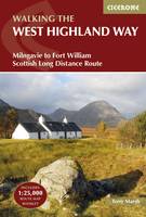
Paperback. Guidebook to walking the West Highland Way National Trail, a 95 mile Scottish long-distance route from Milngavie near Glasgow to Fort William, passing Loch Lomond and crossing Rannoch Moor. Suggested itineraries over 6 to 9 days. Includes accommodation guide and pull-out 1:25K OS map booklet. Num Pages: 144 pages, 52 photos 14 maps. BIC Classification: 1DBKSH; WSZC; WTH. Category: (G) General (US: Trade). Dimension: 121 x 178 x 14. Weight in Grams: 246.
- Publisher
- Cicerone Press Limited
- Format
- Paperback
- Publication date
- 2016
- Edition
- 4th Edition
- Condition
- New
- SKU
- V9781852848576
- ISBN
- 9781852848576
Paperback
Condition: New
€ 23.99€ 22.15
€ 23.99
€ 22.15
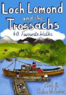
Paperback. The Loch Lomond National Park has ensured protection for what is not only Britain's largest freshwater lake, but one of its most beautiful, celebrated in ballad and song. West of Loch Lomond are the steep Arrochar Alps towering above Loch Long. This guide features 40 of the best walks in this popular area. Num Pages: 96 pages, full colour illustrations. BIC Classification: 1DBKS; WSZC. Category: (G) General (US: Trade). Dimension: 148 x 106 x 9. Weight in Grams: 126.
- Publisher
- Pocket Mountains Ltd United Kingdom
- Number of pages
- 96
- Format
- Paperback
- Publication date
- 2010
- Condition
- New
- SKU
- V9781907025044
- ISBN
- 9781907025044
Paperback
Condition: New
€ 10.01
€ 10.01
Sheet map, folded. Series: OS Explorer Map. BIC Classification: 1DBKEMW; WSZC; WTRM. Category: (G) General (US: Trade). Dimension: 136 x 241 x 28. Weight in Grams: 128.
- Publisher
- Ordnance Survey
- Publication date
- 2015
- Edition
- September 2015 ed
- Condition
- New
- SKU
- V9780319243992
- ISBN
- 9780319243992
Paperback
Condition: New
€ 16.99€ 13.95
€ 16.99
€ 13.95
Sheet map, folded. .
- Publisher
- Ordnance Survey
- Publication date
- 2015
- Edition
- September 2015 ed
- Condition
- New
- SKU
- V9780319243510
- ISBN
- 9780319243510
Paperback
Condition: New
€ 16.99€ 13.76
€ 16.99
€ 13.76
Paperback. Series: Birds, Boots and Butties. Num Pages: 112 pages, col. Illustrations, maps. BIC Classification: 1DBKWN; WSZC; WTH. Category: (G) General (US: Trade). Dimension: 182 x 126 x 7. Weight in Grams: 164.
- Publisher
- Llygad Gwalch Cyf United Kingdom
- Number of pages
- 112
- Format
- Paperback
- Publication date
- 2009
- Edition
- UK ed.
- Condition
- New
- SKU
- V9781845241483
- ISBN
- 9781845241483
Paperback
Condition: New
€ 11.02
€ 11.02
Sheet map, folded. .
- Publisher
- Ordnance Survey
- Publication date
- 2016
- Edition
- February 2016 ed
- Condition
- New
- SKU
- V9780319262658
- ISBN
- 9780319262658
Paperback
Condition: New
€ 16.99€ 13.77
€ 16.99
€ 13.77
Paperback. Features British Adventures. In this book, the author shares the (mis)adventures with her family and her wayward Tibetan terrier Archie. Num Pages: 304 pages. BIC Classification: 1DB; BM; VFV; WSZC. Category: (G) General (US: Trade). Dimension: 130 x 197 x 23. Weight in Grams: 240.
- Publisher
- Penguin
- Format
- Paperback
- Publication date
- 2015
- Edition
- UK ed.
- Condition
- New
- SKU
- V9780241959770
- ISBN
- 9780241959770
Paperback
Condition: New
€ 14.99€ 11.49
€ 14.99
€ 11.49
Sheet map, folded. .
- Publisher
- Ordnance Survey
- Publication date
- 2015
- Edition
- September 2015 ed
- Condition
- New
- SKU
- V9780319472033
- ISBN
- 9780319472033
Paperback
Condition: New
€ 21.99€ 17.02
€ 21.99
€ 17.02
Paperback. Guidebook to trekking the Zillertal Rucksack Route (or Berliner Hoehen Weg) and the Zillertal South Tyrol Tour in the Austrian Tyrol. The ZRR avoids glaciers and difficult passes so is suitable for inexperienced trekkers. The ZSTT traverses the whole range along the Austro-Italian border. Each takes 8-10 days and has excellent Alpine huts on route. Num Pages: 208 pages, 85 colour photos and 25 maps and profiles. BIC Classification: 1DFA; WSZC; WSZG. Category: (G) General (US: Trade). Dimension: 177 x 118 x 13. Weight in Grams: 266. 208 pages, 85 colour photos and 25 maps and profiles. Guidebook to trekking the Zillertal Rucksack Route (or Berliner Hoehen Weg) and the Zillertal South Tyrol Tour in the Austrian Tyrol. The ZRR avoids glaciers and difficult passes so is suitable for inexperienced trekkers. The ZSTT traverses the whole range along the Austro-Italian border. Each takes 8-10 days and has excellent Alpine huts on route. Cateogry: (G) General (US: Trade). BIC Classification: 1DFA; WSZC; WSZG. Dimension: 177 x 118 x 13. Weight: 266.
- Publisher
- Cicerone Press Limited
- Number of pages
- 208
- Format
- Paperback
- Publication date
- 2013
- Edition
- 2nd Revised edition
- Condition
- New
- SKU
- V9781852847173
- ISBN
- 9781852847173
Paperback
Condition: New
€ 20.99€ 19.12
€ 20.99
€ 19.12
Series: OS Explorer Map. BIC Classification: 1DBKEWS; WSZC; WTRM. Category: (G) General (US: Trade). Dimension: 136 x 240 x 46. Weight in Grams: 128.
- Publisher
- Ordnance Survey
- Publication date
- 2015
- Edition
- September 2015 ed
- Condition
- New
- SKU
- V9780319243480
- ISBN
- 9780319243480
Paperback
Condition: New
€ 16.99€ 13.77
€ 16.99
€ 13.77


